Weather Alert in New Mexico
Hydrologic Outlook issued August 28 at 9:06AM MDT by NWS Albuquerque NM
AREAS AFFECTED: Colfax, NM; Mora, NM; San Miguel, NM; Taos, NM
DESCRIPTION: ESFABQ Heightened Risk of River and Stream Flooding During Storm Events Through the Holiday Weekend. Repeated rounds of heavy rainfall in the area over the last several days have saturated the soils and raised the baseflow of rivers and streams in the area. We have reports of streams near the Mora, Sapello, Pecos and Vermejo river rising out of their banks, with additional reports of flowing water and debris across roads such as 518. These waterways will be extremely vulnerable to further rounds of precipitation, which we are expecting over the next week as a surge of deep monsoon moisture moves through the area. Expect further rises and impacts to nearby roads and low water crossings. Stay aware of any flash flood or river flood warnings that are issued. Exercise caution along riverbanks and watch out for potential mudslides across roads. For questions or comments about this outlook, you can contact Andrew Mangham, Senior Service Hydrologist, at 505-244-9150 x 228 or via e- mail at andrew.mangham@noaa.gov.
INSTRUCTION: N/A
Want more detail? Get the Complete 7 Day and Night Detailed Forecast!
Current U.S. National Radar--Current
The Current National Weather Radar is shown below with a UTC Time (subtract 5 hours from UTC to get Eastern Time).

National Weather Forecast--Current
The Current National Weather Forecast and National Weather Map are shown below.

National Weather Forecast for Tomorrow
Tomorrow National Weather Forecast and Tomorrow National Weather Map are show below.

North America Water Vapor (Moisture)
This map shows recent moisture content over North America. Bright and colored areas show high moisture (ie, clouds); brown indicates very little moisture present; black indicates no moisture.

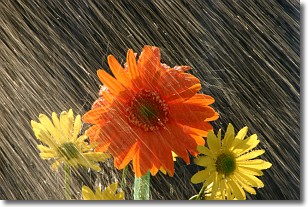
Weather Topic: What is Rain?
Home - Education - Precipitation - Rain
 Next Topic: Shelf Clouds
Precipitation in the form of water droplets is called rain.
Rain generally has a tendency to fall with less intensity over a greater period
of time, and when rainfall is more severe it is usually less sustained.
Rain is the most common form of precipitation and happens with greater frequency
depending on the season and regional influences. Cities have been shown to have
an observable effect on rainfall, due to an effect called the urban heat island.
Compared to upwind, monthly rainfall between twenty and forty miles downwind of
cities is 30% greater.
Next Topic: Shelf Clouds
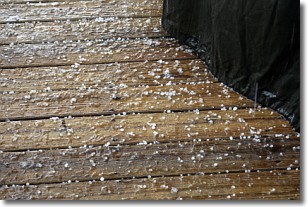
Weather Topic: What is Sleet?
Home - Education - Precipitation - Sleet
 Next Topic: Snow
Sleet is a form of precipitation in which small ice pellets are the primary
components. These ice pellets are smaller and more translucent than hailstones,
and harder than graupel. Sleet is caused by specific atmospheric conditions and
therefore typically doesn't last for extended periods of time.
The condition which leads to sleet formation requires a warmer body of air to be
wedged in between two sub-freezing bodies of air. When snow falls through a warmer
layer of air it melts, and as it falls through the next sub-freezing body of air
it freezes again, forming ice pellets known as sleet. In some cases, water
droplets don't have time to freeze before reaching the surface and the result is
freezing rain.
Next Topic: Snow
Current conditions powered by WeatherAPI.com


