Weather Alert in Georgia
Flood Watch issued August 2 at 3:12PM EDT until August 3 at 4:00AM EDT by NWS Tallahassee FL
AREAS AFFECTED: Quitman; Clay; Randolph; Calhoun; Terrell; Dougherty; Lee; Worth; Turner; Tift; Ben Hill; Irwin; Early; Miller; Baker; Mitchell; Colquitt; Cook; Berrien; Decatur; Grady; Thomas; Brooks; Lowndes; Lanier
DESCRIPTION: * WHAT...Flash flooding caused by excessive rainfall is possible across Southwest and South Central Georgia. * WHERE...For the following counties in South Central Georgia, Ben Hill, Berrien, Brooks, Colquitt, Cook, Irwin, Lanier, Lowndes, Thomas, Tift, Turner and Worth. In southwest Georgia, Baker, Calhoun, Clay, Decatur, Dougherty, Early, Grady, Lee, Miller, Mitchell, Quitman, Randolph and Terrell. * WHEN...Through 4 AM EDT Sunday Morning. * IMPACTS...Excessive runoff may result in flash flooding of roadways as well as greater impacts in urban areas where flood-prone neighborhoods could be especially vulnerable to rising water. Small creeks may also rise rapidly, leading to flooding. * ADDITIONAL DETAILS... - A very moist airmass is in place across the region and numerous showers and thunderstorms are expected to develop later this afternoon and evening across South Georgia. Due to the slow motion of these storms, some areas could see rainfall totals of 3 to 5 inches with isolated maximum amounts of 7 inches through tonight. - http://www.weather.gov/safety/flood
INSTRUCTION: You should monitor later forecasts and be alert for possible Flash Flood Warnings. Those living in areas prone to flooding should be prepared to take action should flash flooding develop.
Want more detail? Get the Complete 7 Day and Night Detailed Forecast!
Current U.S. National Radar--Current
The Current National Weather Radar is shown below with a UTC Time (subtract 5 hours from UTC to get Eastern Time).

National Weather Forecast--Current
The Current National Weather Forecast and National Weather Map are shown below.

National Weather Forecast for Tomorrow
Tomorrow National Weather Forecast and Tomorrow National Weather Map are show below.

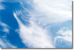
North America Water Vapor (Moisture)
This map shows recent moisture content over North America. Bright and colored areas show high moisture (ie, clouds); brown indicates very little moisture present; black indicates no moisture.

Weather Topic: What are Wall Clouds?
Home - Education - Cloud Types - Wall Clouds
 Next Topic: Altocumulus Clouds
A wall cloud forms underneath the base of a cumulonimbus cloud,
and can be a hotbed for deadly tornadoes.
Wall clouds are formed by air flowing into the cumulonimbus clouds, which can
result in the wall cloud descending from the base of the cumulonimbus cloud, or
rising fractus clouds which join to the base of the storm cloud as the wall cloud
takes shape.
Wall clouds can be very large, and in the Northern Hemisphere they generally
form at the southern edge of cumulonimbus clouds.
Next Topic: Altocumulus Clouds
Weather Topic: What are Altostratus Clouds?
Home - Education - Cloud Types - Altostratus Clouds
 Next Topic: Cirrocumulus Clouds
Altostratus clouds form at mid to high-level altitudes
(between 2 and 7 km) and are created by a warm, stable air mass which causes
water vapor
to condense as it rise through the atmosphere. Usually altostratus clouds are
featureless sheets characterized by a uniform color.
In some cases, wind punching through the cloud formation may give it a waved
appearance, called altostratus undulatus. Altostratus clouds
are commonly seen with other cloud formations accompanying them.
Next Topic: Cirrocumulus Clouds
Current conditions powered by WeatherAPI.com


