Weather Alert in Texas
Wind Advisory issued April 18 at 10:53AM MDT until April 18 at 8:00PM MDT by NWS El Paso Tx/Santa Teresa NM
AREAS AFFECTED: Northern Hudspeth Highlands/Hueco Mountains; Salt Basin
DESCRIPTION: * WHAT...For the Blowing Dust Advisory, visibility between one-quarter and one mile in blowing dust expected. For the Wind Advisory, southwest winds 25 to 35 mph with gusts up to 50 mph expected. * WHERE...Northern Hudspeth Highlands/Hueco Mountains and Salt Basin. * WHEN...Until 8 PM MDT this evening. * IMPACTS...Hazardous driving conditions due to reduced visibility. Gusty winds will blow around unsecured objects. Tree limbs could be blown down and a few power outages may result.
INSTRUCTION: Persons with respiratory problems should make preparations to stay indoors until the storm passes. Be ready for a sudden drop in visibility to near zero. If you encounter blowing dust or blowing sand on the roadway or see it approaching, pull off the road as far as possible and put your vehicle in park. Turn the lights all the way off and keep foot off the brake pedal. Remember, 'Pull Aside, Stay Alive'. Winds this strong can make driving difficult, especially for high profile vehicles. Use extra caution. Secure outdoor objects.
Want more detail? Get the Complete 7 Day and Night Detailed Forecast!
Current U.S. National Radar--Current
The Current National Weather Radar is shown below with a UTC Time (subtract 5 hours from UTC to get Eastern Time).

National Weather Forecast--Current
The Current National Weather Forecast and National Weather Map are shown below.

National Weather Forecast for Tomorrow
Tomorrow National Weather Forecast and Tomorrow National Weather Map are show below.

North America Water Vapor (Moisture)
This map shows recent moisture content over North America. Bright and colored areas show high moisture (ie, clouds); brown indicates very little moisture present; black indicates no moisture.

Weather Topic: What are Hole Punch Clouds?
Home - Education - Cloud Types - Hole Punch Clouds
 Next Topic: Mammatus Clouds
A hole punch cloud is an unusual occurrence when a disk-shaped
hole appears in a cirrostratus, cirrocumulus, or altocumulus cloud.
When part of the cloud forms ice crystals, water droplets in the surrounding area
of the cloud evaporate. The effect of this process produces a large elliptical
gap in the cloud. The hole punch cloud formation is rare, but it is not specific
to any geographic area.
Other names which have been used to describe this phenomena include fallstreak hole,
skypunch, and cloud hole.
Next Topic: Mammatus Clouds
Weather Topic: What are Nimbostratus Clouds?
Home - Education - Cloud Types - Nimbostratus Clouds
 Next Topic: Precipitation
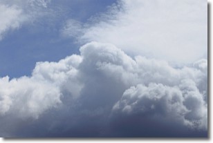
A nimbostratus cloud is similar to a stratus cloud in its formless,
smooth appearance. However, a nimbostratus cloud is darker than a stratus cloud,
because it is thicker.
Unlike a stratus cloud, a nimbostratus cloud typically brings with it the threat
of moderate to heavy precipitation. In some cases, the precipitation may evaporate
before reaching the ground, a phenomenon known as virga.
Next Topic: Precipitation
Current conditions powered by WeatherAPI.com


