Weather Alert in Wisconsin
Flood Warning issued August 13 at 10:16AM CDT by NWS Milwaukee/Sullivan WI
AREAS AFFECTED: Dodge, WI
DESCRIPTION: ...The National Weather Service in Milwaukee/Sullivan WI has issued a Flood Warning for the following rivers in Wisconsin... ROCK RIVER near LEBANON-3 E-HWY MM BRIDGE affecting Dodge County. * WHAT...The Rock River at Lebanon is expected to rise above flood stage within the next few hours. * WHERE...ROCK RIVER near LEBANON-3 E-HWY MM BRIDGE. * WHEN...From this morning until further notice. * ADDITIONAL DETAILS... - At 9:00 AM CDT Wednesday the stage was 9.7 feet. - Bankfull stage is 9.0 feet. - Forecast...No forecast is available for this location. - Flood stage is 10.0 feet. - Flood History...This crest compares to a previous crest of 9.7 feet on 04/11/2022. - http://www.weather.gov/safety/flood
INSTRUCTION: Turn around, don't drown when encountering flooded roads. Most flood deaths occur in vehicles. Additional information is available at www.weather.gov. The next statement will be issued by this evening.this evening at 1030 PM CDT.
Want more detail? Get the Complete 7 Day and Night Detailed Forecast!
Current U.S. National Radar--Current
The Current National Weather Radar is shown below with a UTC Time (subtract 5 hours from UTC to get Eastern Time).

National Weather Forecast--Current
The Current National Weather Forecast and National Weather Map are shown below.

National Weather Forecast for Tomorrow
Tomorrow National Weather Forecast and Tomorrow National Weather Map are show below.

North America Water Vapor (Moisture)
This map shows recent moisture content over North America. Bright and colored areas show high moisture (ie, clouds); brown indicates very little moisture present; black indicates no moisture.

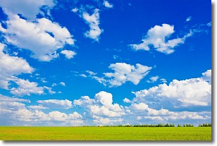
Weather Topic: What are Cumulus Clouds?
Home - Education - Cloud Types - Cumulus Clouds
 Next Topic: Drizzle
Cumulus clouds are fluffy and textured with rounded tops, and
may have flat bottoms. The border of a cumulus cloud
is clearly defined, and can have the appearance of cotton or cauliflower.
Cumulus clouds form at low altitudes (rarely above 2 km) but can grow very tall,
becoming cumulus congestus and possibly the even taller cumulonimbus clouds.
When cumulus clouds become taller, they have a greater chance of producing precipitation.
Next Topic: Drizzle
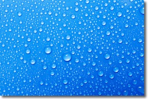
Weather Topic: What is Evaporation?
Home - Education - Precipitation - Evaporation
 Next Topic: Fog
Evaporation is the process which returns water from the earth
back to the atmosphere, and is another crucial process in the water cycle.
Evaporation is the transformation of liquid into gas, and it happens because
molecules are excited by the application of energy and turn into vapor.
In order for water to evaporate it has to be on the surface of a body of water.
Next Topic: Fog
Current conditions powered by WeatherAPI.com


