Weather Alert in Georgia
Flood Warning issued August 24 at 11:07AM EDT until August 25 at 2:00AM EDT by NWS Peachtree City GA
AREAS AFFECTED: Bibb, GA; Houston, GA; Jones, GA; Twiggs, GA
DESCRIPTION: ...The Flood Warning continues for the following rivers in Georgia... Ocmulgee River near Macon affecting Twiggs, Jones, Houston and Bibb Counties. * WHAT...Minor flooding is occurring and minor flooding is forecast to continue. * WHERE...Ocmulgee River near Macon. * WHEN...Until late tonight. * IMPACTS...Between 18 and 19 feet, Flood stage is reached. Minor flooding begins along the river upstream and downstream from the gage at U.S. Highway 80 or Martin Luther King Boulevard. Portions of the Ocmulgee Heritage Trail and agricultural lands well downstream will be under a foot of water. Access roads and trails in Amerson Park upstream of the gage site begin to flood. * ADDITIONAL DETAILS... - At 10:30 AM EDT Sunday the stage was 18.2 feet and rising. - Recent Activity...The maximum river stage in the 24 hours ending at 10:30 AM EDT Sunday was 18.2 feet. - Forecast...The river is expected to rise to a crest of 18.4 feet this afternoon. It will then fall below flood stage this evening. - Flood stage is 18 feet. - http://www.weather.gov/safety/flood
INSTRUCTION: Turn around, don't drown when encountering flooded roads. Most flood deaths occur in vehicles. Additional information is available at weather.gov/atlanta.
Want more detail? Get the Complete 7 Day and Night Detailed Forecast!
Current U.S. National Radar--Current
The Current National Weather Radar is shown below with a UTC Time (subtract 5 hours from UTC to get Eastern Time).

National Weather Forecast--Current
The Current National Weather Forecast and National Weather Map are shown below.

National Weather Forecast for Tomorrow
Tomorrow National Weather Forecast and Tomorrow National Weather Map are show below.

North America Water Vapor (Moisture)
This map shows recent moisture content over North America. Bright and colored areas show high moisture (ie, clouds); brown indicates very little moisture present; black indicates no moisture.

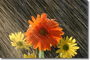
Weather Topic: What is Rain?
Home - Education - Precipitation - Rain
 Next Topic: Shelf Clouds
Precipitation in the form of water droplets is called rain.
Rain generally has a tendency to fall with less intensity over a greater period
of time, and when rainfall is more severe it is usually less sustained.
Rain is the most common form of precipitation and happens with greater frequency
depending on the season and regional influences. Cities have been shown to have
an observable effect on rainfall, due to an effect called the urban heat island.
Compared to upwind, monthly rainfall between twenty and forty miles downwind of
cities is 30% greater.
Next Topic: Shelf Clouds
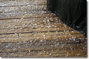
Weather Topic: What is Sleet?
Home - Education - Precipitation - Sleet
 Next Topic: Snow
Sleet is a form of precipitation in which small ice pellets are the primary
components. These ice pellets are smaller and more translucent than hailstones,
and harder than graupel. Sleet is caused by specific atmospheric conditions and
therefore typically doesn't last for extended periods of time.
The condition which leads to sleet formation requires a warmer body of air to be
wedged in between two sub-freezing bodies of air. When snow falls through a warmer
layer of air it melts, and as it falls through the next sub-freezing body of air
it freezes again, forming ice pellets known as sleet. In some cases, water
droplets don't have time to freeze before reaching the surface and the result is
freezing rain.
Next Topic: Snow
Current conditions powered by WeatherAPI.com


