Weather Alert in California
Flood Warning issued February 24 at 7:47PM PST until February 26 at 9:52AM PST by NWS Sacramento CA
AREAS AFFECTED: Tehama, CA
DESCRIPTION: ...The National Weather Service in Sacramento CA has issued a Flood Warning for the following rivers in California... Sacramento River At Tehama Bridge affecting Tehama County. Sacramento River At Vina Woodson Bridge affecting Tehama County. .Minor Flooding At Tehama Bridge and Vina Woodson; Action/Monitor Stage for Most Forecast Points Along the Upper Sacramento River System. For the Upper Sacramento River...including Tehama Bridge and Vina Woodson Bridge...Minor flooding is forecast. * WHAT...Minor flooding is forecast. * WHERE...Sacramento River at Tehama Bridge. * WHEN...From this evening to late Thursday morning. * IMPACTS...At 210.7 feet, Between 210 and 211 feet the county park becomes inaccessible. At 211 feet water begins to enter Driftwood RV fishing resort on east bank of river and just north of the county park. * ADDITIONAL DETAILS... - At 7:00 PM PST Tuesday the stage was 206.1 feet. - Bankfull stage is 206.5 feet. - Forecast...The river is expected to rise above flood stage late this evening to a crest of 212.4 feet tomorrow morning. It will then fall below flood stage tomorrow afternoon. - Flood stage is 209.5 feet. - Flood History...This crest compares to a previous crest of 212.3 feet on 02/19/2024. - http://www.weather.gov/safety/flood
INSTRUCTION: Turn around, don't drown when encountering flooded roads. Most flood deaths occur in vehicles. For more hydrologic information and stage definitions refer to the following web site: wrh.noaa.gov/sto/hydro_data.php The next statement will be issued Wednesday evening at 800 PM PST.
Want more detail? Get the Complete 7 Day and Night Detailed Forecast!
Current U.S. National Radar--Current
The Current National Weather Radar is shown below with a UTC Time (subtract 5 hours from UTC to get Eastern Time).

National Weather Forecast--Current
The Current National Weather Forecast and National Weather Map are shown below.

National Weather Forecast for Tomorrow
Tomorrow National Weather Forecast and Tomorrow National Weather Map are show below.

North America Water Vapor (Moisture)
This map shows recent moisture content over North America. Bright and colored areas show high moisture (ie, clouds); brown indicates very little moisture present; black indicates no moisture.

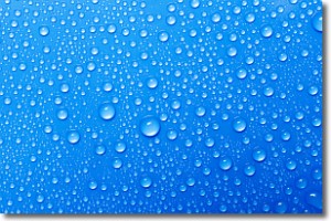
Weather Topic: What is Evaporation?
Home - Education - Precipitation - Evaporation
 Next Topic: Fog
Evaporation is the process which returns water from the earth
back to the atmosphere, and is another crucial process in the water cycle.
Evaporation is the transformation of liquid into gas, and it happens because
molecules are excited by the application of energy and turn into vapor.
In order for water to evaporate it has to be on the surface of a body of water.
Next Topic: Fog
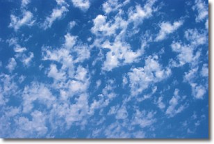
Weather Topic: What are Fractus Clouds?
Home - Education - Cloud Types - Fractus Clouds
 Next Topic: Freezing Rain
A fractus cloud (scud) is a fragmented, tattered cloud which has
likely been sheared off of another cloud. They are accessory clouds, meaning they
develop from parent clouds, and are named in a way which describes the original
cloud which contained them.
Fractus clouds which have originated from cumulus clouds are referred to as
cumulus fractus, while fractus clouds which have originated from stratus clouds
are referred to as stratus fractus. Under certain conditions a fractus cloud might
merge with another cloud, or develop into a cumulus cloud, but usually a
fractus cloud seen by itself will dissipate rapidly.
They are often observed on the leading and trailing edges of storm clouds,
and are a display of wind activity.
Next Topic: Freezing Rain
Current conditions powered by WeatherAPI.com


