Weather Alert in California
Flood Advisory issued August 26 at 1:32PM PDT until August 26 at 3:30PM PDT by NWS Reno NV
AREAS AFFECTED: Alpine, CA
DESCRIPTION: * WHAT...Flooding caused by excessive rainfall is expected. * WHERE...A portion of the Tamarack burn scar in eastern Alpine. * WHEN...Until 330 PM PDT. * IMPACTS...Areas of flash flooding and debris flows. * ADDITIONAL DETAILS... - At 131 PM PDT, Doppler radar indicated heavy rain due to thunderstorms. Minor flooding is ongoing or expected to begin shortly in the advisory area. Between 0.5 and 1 inch of rain has fallen. - Some locations that will experience flooding include... Grover Hot Springs, Alpine Village, Woodfords, Mesa Vista, Alpine County Airport, Turtle Rock Campground, Junction CA 89 And CA 4, Indian Creek Campground, Indian Creek Reservoir and Markleeville. - http://www.weather.gov/safety/flood
INSTRUCTION: Turn around, don't drown when encountering flooded roads. Most flood deaths occur in vehicles. Recent burn areas are more prone to flooding, debris flows, and rock falls. Plugged culverts, rocks and debris on roads, and water and mud over roads are common during moderate to heavy rains. Increased sediment and debris can lead to impacts in areas typically not prone to flooding. Use extra caution when traveling in or below recent burn areas. Impactful flooding and debris flows may be generated by 15 minutes or less of heavy rainfall.
Want more detail? Get the Complete 7 Day and Night Detailed Forecast!
Current U.S. National Radar--Current
The Current National Weather Radar is shown below with a UTC Time (subtract 5 hours from UTC to get Eastern Time).

National Weather Forecast--Current
The Current National Weather Forecast and National Weather Map are shown below.

National Weather Forecast for Tomorrow
Tomorrow National Weather Forecast and Tomorrow National Weather Map are show below.

North America Water Vapor (Moisture)
This map shows recent moisture content over North America. Bright and colored areas show high moisture (ie, clouds); brown indicates very little moisture present; black indicates no moisture.

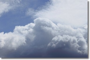
Weather Topic: What are Nimbostratus Clouds?
Home - Education - Cloud Types - Nimbostratus Clouds
 Next Topic: Precipitation
A nimbostratus cloud is similar to a stratus cloud in its formless,
smooth appearance. However, a nimbostratus cloud is darker than a stratus cloud,
because it is thicker.
Unlike a stratus cloud, a nimbostratus cloud typically brings with it the threat
of moderate to heavy precipitation. In some cases, the precipitation may evaporate
before reaching the ground, a phenomenon known as virga.
Next Topic: Precipitation
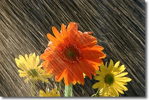
Weather Topic: What is Rain?
Home - Education - Precipitation - Rain
 Next Topic: Shelf Clouds
Precipitation in the form of water droplets is called rain.
Rain generally has a tendency to fall with less intensity over a greater period
of time, and when rainfall is more severe it is usually less sustained.
Rain is the most common form of precipitation and happens with greater frequency
depending on the season and regional influences. Cities have been shown to have
an observable effect on rainfall, due to an effect called the urban heat island.
Compared to upwind, monthly rainfall between twenty and forty miles downwind of
cities is 30% greater.
Next Topic: Shelf Clouds
Current conditions powered by WeatherAPI.com


