Weather Alert in Missouri
Flood Warning issued June 10 at 8:08AM CDT until June 11 at 10:30PM CDT by NWS Springfield MO
AREAS AFFECTED: Vernon, MO
DESCRIPTION: ...The Flood Warning continues for the following rivers in Missouri... Little Osage River near Horton affecting Vernon County. Osage River at Taberville affecting St. Clair and Vernon Counties. ...The Flood Warning is extended for the following rivers in Missouri... Marmaton River near Nevada affecting Vernon County. For the Little Osage River...including Fulton, Horton...Minor flooding is forecast. For the Marmaton River...including Fort Scott, Nevada...Minor flooding is forecast. For the Osage River...including Taberville...Minor flooding is forecast. * WHAT...Minor flooding is occurring and minor flooding is forecast. * WHERE...Marmaton River near Nevada. * WHEN...Until late tomorrow evening. * IMPACTS...At 22.0 feet, flood waters impact the county road west of Nevada at the gage site. * ADDITIONAL DETAILS... - At 7:45 AM CDT Tuesday the stage was 21.7 feet. - Bankfull stage is 20.0 feet. - Recent Activity...The maximum river stage in the 24 hours ending at 7:45 AM CDT Tuesday was 22.2 feet. - Forecast...The river is expected to fall below flood stage late this evening and continue falling to 6.7 feet Sunday morning. - Flood stage is 20.0 feet. - http://www.weather.gov/safety/flood
INSTRUCTION: Turn around, don't drown when encountering flooded roads. Many flood deaths occur in vehicles. Additional information is available at www.weather.gov. The next statement will be issued Wednesday morning at 815 AM CDT.
Want more detail? Get the Complete 7 Day and Night Detailed Forecast!
Current U.S. National Radar--Current
The Current National Weather Radar is shown below with a UTC Time (subtract 5 hours from UTC to get Eastern Time).

National Weather Forecast--Current
The Current National Weather Forecast and National Weather Map are shown below.

National Weather Forecast for Tomorrow
Tomorrow National Weather Forecast and Tomorrow National Weather Map are show below.

North America Water Vapor (Moisture)
This map shows recent moisture content over North America. Bright and colored areas show high moisture (ie, clouds); brown indicates very little moisture present; black indicates no moisture.

Weather Topic: What are Hole Punch Clouds?
Home - Education - Cloud Types - Hole Punch Clouds
 Next Topic: Mammatus Clouds
A hole punch cloud is an unusual occurrence when a disk-shaped
hole appears in a cirrostratus, cirrocumulus, or altocumulus cloud.
When part of the cloud forms ice crystals, water droplets in the surrounding area
of the cloud evaporate. The effect of this process produces a large elliptical
gap in the cloud. The hole punch cloud formation is rare, but it is not specific
to any geographic area.
Other names which have been used to describe this phenomena include fallstreak hole,
skypunch, and cloud hole.
Next Topic: Mammatus Clouds
Weather Topic: What are Nimbostratus Clouds?
Home - Education - Cloud Types - Nimbostratus Clouds
 Next Topic: Precipitation
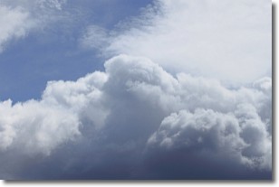
A nimbostratus cloud is similar to a stratus cloud in its formless,
smooth appearance. However, a nimbostratus cloud is darker than a stratus cloud,
because it is thicker.
Unlike a stratus cloud, a nimbostratus cloud typically brings with it the threat
of moderate to heavy precipitation. In some cases, the precipitation may evaporate
before reaching the ground, a phenomenon known as virga.
Next Topic: Precipitation
Current conditions powered by WeatherAPI.com


