Weather Alert in Arizona
Flash Flood Warning issued July 16 at 1:38PM MST until July 16 at 4:30PM MST by NWS Flagstaff AZ
AREAS AFFECTED: Coconino, AZ
DESCRIPTION: FFWFGZ The National Weather Service in Flagstaff has issued a * Flash Flood Warning for... Coconino County in north central Arizona...This includes the Colorado River between mile markers 20 and 51. * Until 430 PM MST /530 PM MDT/. * At 138 PM MST /238 PM MDT/, Doppler radar indicated thunderstorms producing heavy rain across the portions of the Grand Canyon northeast of the North Rim. Between 1 and 1.75 inches of rain have fallen. Additional rainfall amounts of 0.5 to 1 inch are possible in the warned area. Flash flooding is ongoing or expected to begin shortly. HAZARD...Life threatening flash flooding. Thunderstorms producing flash flooding. SOURCE...Radar indicated. IMPACT...Life threatening flash flooding of creeks and streams, normally dry washes, urban areas, highways, streets and underpasses. * Some locations that will experience flash flooding include... Horseshoe Reservoir, Saddle Mountain Overlook, Point Imperial Picnic Area, Grand Canyon National Park, Bert Loper's Boat, Royal Arches, Anasazi Foot Bridge, Point Hansbrough, Triple Alcoves and Saddle Mountain Wilderness. This includes the Colorado River between mile markers 20 and 51. This includes the following creeks, washes and rivers... South Canyon, Nautiloid Canyon, North Canyon Wash, Saddle Canyon, Sheep Spring Wash, To Hajisho, Colorado River, "Redbud Alcove", Bright Angel Creek, Tatahoysa Wash, House Rock Wash, Tatahatso Wash, Tiger Wash, Shinumo Wash, Buck Farm Canyon, Nankoweap Canyon, "22- Mile Wash", "Bert's Canyon", North Canyon and Little Nankoweap Creek.
INSTRUCTION: Flooding of washes and creeks will occur, some dirt roads will become muddy and impassable. Paved roads and underpasses could become flooded as well.
Want more detail? Get the Complete 7 Day and Night Detailed Forecast!
Current U.S. National Radar--Current
The Current National Weather Radar is shown below with a UTC Time (subtract 5 hours from UTC to get Eastern Time).

National Weather Forecast--Current
The Current National Weather Forecast and National Weather Map are shown below.

National Weather Forecast for Tomorrow
Tomorrow National Weather Forecast and Tomorrow National Weather Map are show below.

North America Water Vapor (Moisture)
This map shows recent moisture content over North America. Bright and colored areas show high moisture (ie, clouds); brown indicates very little moisture present; black indicates no moisture.

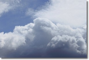
Weather Topic: What are Nimbostratus Clouds?
Home - Education - Cloud Types - Nimbostratus Clouds
 Next Topic: Precipitation
A nimbostratus cloud is similar to a stratus cloud in its formless,
smooth appearance. However, a nimbostratus cloud is darker than a stratus cloud,
because it is thicker.
Unlike a stratus cloud, a nimbostratus cloud typically brings with it the threat
of moderate to heavy precipitation. In some cases, the precipitation may evaporate
before reaching the ground, a phenomenon known as virga.
Next Topic: Precipitation
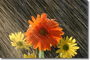
Weather Topic: What is Rain?
Home - Education - Precipitation - Rain
 Next Topic: Shelf Clouds
Precipitation in the form of water droplets is called rain.
Rain generally has a tendency to fall with less intensity over a greater period
of time, and when rainfall is more severe it is usually less sustained.
Rain is the most common form of precipitation and happens with greater frequency
depending on the season and regional influences. Cities have been shown to have
an observable effect on rainfall, due to an effect called the urban heat island.
Compared to upwind, monthly rainfall between twenty and forty miles downwind of
cities is 30% greater.
Next Topic: Shelf Clouds
Current conditions powered by WeatherAPI.com


