Weather Alert in North Carolina
Storm Surge Warning issued August 20 at 10:50PM EDT by NWS Newport/Morehead City NC
AREAS AFFECTED: East Carteret
DESCRIPTION: * LOCATIONS AFFECTED - Beaufort - Harkers Island - Cedar Island * WIND - LATEST LOCAL FORECAST: Below tropical storm force wind - Peak Wind Forecast: 25-35 mph with gusts to 45 mph - THREAT TO LIFE AND PROPERTY THAT INCLUDES TYPICAL FORECAST UNCERTAINTY IN TRACK, SIZE AND INTENSITY: Wind less than 39 mph - The wind threat has decreased from the previous assessment. - PLAN: The sustained wind should remain less than tropical storm force. Conditions may still be gusty. - PREPARE: Listen for any instructions from local officials. - ACT: Ensure emergency readiness should the forecast change. - REALIZED IMPACTS: Being Assessed - Little to no additional wind impacts expected. Community officials are now assessing the extent of actual wind impacts accordingly. * STORM SURGE - LATEST LOCAL FORECAST: Life-threatening storm surge possible - Peak Storm Surge Inundation: The potential for 2-4 feet above ground somewhere within surge prone areas - Window of concern: Begins this evening - THREAT TO LIFE AND PROPERTY THAT INCLUDES TYPICAL FORECAST UNCERTAINTY IN TRACK, SIZE AND INTENSITY: Potential for storm surge flooding greater than 3 feet above ground - The storm surge threat has remained nearly steady from the previous assessment. - PLAN: Plan for life-threatening storm surge flooding of greater than 3 feet above ground. - PREPARE: Evacuation efforts and flood preparations should soon be brought to completion before conditions become unsafe. - ACT: Leave immediately if evacuation orders are given for your area to avoid being cut off from emergency services or needlessly risk lives. - POTENTIAL IMPACTS: Significant - Areas of inundation with storm surge flooding accentuated by waves. Damage to several buildings, mainly near the coast. - Sections of near-shore escape routes and secondary roads become weakened or washed out, especially in usually vulnerable low spots. - Major beach erosion with heavy surf breaching dunes. Strong and numerous rip currents. - Moderate damage to marinas, docks, boardwalks, and piers. Several small craft broken away from moorings, especially in unprotected anchorages. * FLOODING RAIN - LATEST LOCAL FORECAST: - Peak Rainfall Amounts: No additional significant rainfall forecast - THREAT TO LIFE AND PROPERTY THAT INCLUDES TYPICAL FORECAST UNCERTAINTY IN TRACK, SIZE AND INTENSITY: Little or no potential for flooding rain - The flooding rain threat has decreased from the previous assessment. - PLAN: There is little or no potential for flooding rain. - PREPARE: Little to no preparations are needed to protect against flooding rain at this time. - ACT: Monitor for changes to the forecast. - POTENTIAL IMPACTS: Little to None - Little to no potential impacts from flooding rain. * TORNADO - LATEST LOCAL FORECAST: - Situation is unfavorable for tornadoes - THREAT TO LIFE AND PROPERTY THAT INCLUDES TYPICAL FORECAST UNCERTAINTY IN TRACK, SIZE AND INTENSITY: Tornadoes not expected - The tornado threat has remained nearly steady from the previous assessment. - PLAN: Tornadoes are not expected. Showers and thunderstorms with gusty winds may still occur. - PREPARE: Little to no preparations needed to protect against tornadoes at this time. Keep informed of the latest tornado situation. - ACT: Listen for changes in the forecast. - POTENTIAL IMPACTS: Little to None - Little to no potential impacts from tornadoes. * FOR MORE INFORMATION: - http://ready.gov/hurricanes
INSTRUCTION: N/A
Want more detail? Get the Complete 7 Day and Night Detailed Forecast!
Current U.S. National Radar--Current
The Current National Weather Radar is shown below with a UTC Time (subtract 5 hours from UTC to get Eastern Time).

National Weather Forecast--Current
The Current National Weather Forecast and National Weather Map are shown below.

National Weather Forecast for Tomorrow
Tomorrow National Weather Forecast and Tomorrow National Weather Map are show below.

North America Water Vapor (Moisture)
This map shows recent moisture content over North America. Bright and colored areas show high moisture (ie, clouds); brown indicates very little moisture present; black indicates no moisture.

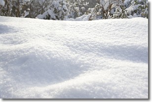
Weather Topic: What is Snow?
Home - Education - Precipitation - Snow
 Next Topic: Stratocumulus Clouds
Snow is precipitation taking the form of ice crystals. Each ice crystal, or snowflake,
has unique characteristics, but all of them grow in a hexagonal structure.
Snowfall can last for sustained periods of time and result in significant buildup
of snow on the ground.
On the earth's surface, snow starts out light and powdery, but as it begins to melt
it tends to become more granular, producing small bits of ice which have the consistency of
sand. After several cycles of melting and freezing, snow can become very dense
and ice-like, commonly known as snow pack.
Next Topic: Stratocumulus Clouds
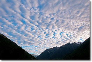
Weather Topic: What are Stratus Clouds?
Home - Education - Cloud Types - Stratus Clouds
 Next Topic: Wall Clouds
Stratus clouds are similar to altostratus clouds, but form at a
lower altitude and are identified by their fog-like appearance, lacking the
distinguishing features of most clouds.
Stratus clouds are wider than most clouds, and their base has a smooth, uniform
look which is lighter in color than a nimbostratus cloud.
The presence of a stratus cloud indicates the possibility of minor precipitation,
such as drizzle, but heavier precipitation does not typically arrive in the form
of a stratus cloud.
Next Topic: Wall Clouds
Current conditions powered by WeatherAPI.com


