Weather Alert in Texas
Flood Advisory issued April 30 at 4:48AM CDT until April 30 at 8:00AM CDT by NWS San Angelo TX
AREAS AFFECTED: Fisher, TX; Haskell, TX; Jones, TX; Nolan, TX; Taylor, TX
DESCRIPTION: * WHAT...Flooding caused by excessive rainfall is expected. * WHERE...A portion of west central Texas, including the following counties, Fisher, Haskell, Jones, Nolan and Taylor. * WHEN...Until 800 AM CDT. * IMPACTS...Minor flooding in low-lying and poor drainage areas. * ADDITIONAL DETAILS... - At 447 AM CDT, Doppler radar indicated heavy rain due to thunderstorms. Minor flooding is ongoing or expected to begin shortly in the advisory area. Between 1 and 2 inches of rain have fallen. - Some locations that will experience flooding include... Sweetwater, Haskell, Stamford, Anson, Hamlin, Roscoe, Merkel, Roby, Rule, Trent, Mccaulley, Sylvester, Neinda, Noodle, Longworth, Sagerton, Wastella, Champion, Paint Creek and The Intersection Of Us-180 And Ranch Road 126. - This includes Interstate 20 between Mile Markers 229 and 271. This includes the following Low Water Crossings... US 180 crossing 7 miles west of Roby, IH 20 frontage roads crossing Sweetwater Creek, IH 20 frontage roads crossing Plum Creek, IH 20 frontage roads crossing Bitter Creek, IH 20 frontage roads crossing Towd Creek, FM 2035 crossing Bitter Creek, County Road 143 crossing Idlewild Creek, County Road 260 crossing Harmony Creek, crossings along County Road 141 and CO Rd. 444 crossing Noodle Creek. - http://www.weather.gov/safety/flood
INSTRUCTION: Turn around, don't drown when encountering flooded roads. Most flood deaths occur in vehicles. Be especially cautious at night when it is harder to recognize the dangers of flooding.
Want more detail? Get the Complete 7 Day and Night Detailed Forecast!
Current U.S. National Radar--Current
The Current National Weather Radar is shown below with a UTC Time (subtract 5 hours from UTC to get Eastern Time).

National Weather Forecast--Current
The Current National Weather Forecast and National Weather Map are shown below.

National Weather Forecast for Tomorrow
Tomorrow National Weather Forecast and Tomorrow National Weather Map are show below.

North America Water Vapor (Moisture)
This map shows recent moisture content over North America. Bright and colored areas show high moisture (ie, clouds); brown indicates very little moisture present; black indicates no moisture.

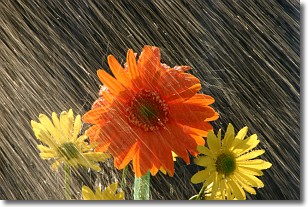
Weather Topic: What is Rain?
Home - Education - Precipitation - Rain
 Next Topic: Shelf Clouds
Precipitation in the form of water droplets is called rain.
Rain generally has a tendency to fall with less intensity over a greater period
of time, and when rainfall is more severe it is usually less sustained.
Rain is the most common form of precipitation and happens with greater frequency
depending on the season and regional influences. Cities have been shown to have
an observable effect on rainfall, due to an effect called the urban heat island.
Compared to upwind, monthly rainfall between twenty and forty miles downwind of
cities is 30% greater.
Next Topic: Shelf Clouds
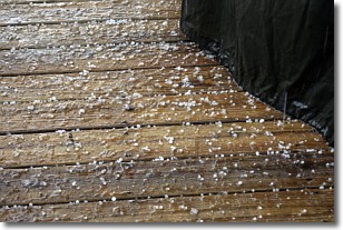
Weather Topic: What is Sleet?
Home - Education - Precipitation - Sleet
 Next Topic: Snow
Sleet is a form of precipitation in which small ice pellets are the primary
components. These ice pellets are smaller and more translucent than hailstones,
and harder than graupel. Sleet is caused by specific atmospheric conditions and
therefore typically doesn't last for extended periods of time.
The condition which leads to sleet formation requires a warmer body of air to be
wedged in between two sub-freezing bodies of air. When snow falls through a warmer
layer of air it melts, and as it falls through the next sub-freezing body of air
it freezes again, forming ice pellets known as sleet. In some cases, water
droplets don't have time to freeze before reaching the surface and the result is
freezing rain.
Next Topic: Snow
Current conditions powered by WeatherAPI.com


