Weather Alert in Colorado
Red Flag Warning issued August 14 at 3:26AM MDT until August 14 at 10:00PM MDT by NWS Pueblo CO
AREAS AFFECTED: Upper Arkansas River Valley Including Lake County and Chaffee County; Fremont County Including Canon City/Howard/Texas Creek; Eastern San Juan Mountains and La Garita Mountains Including Wolf Creek Pass and Creede; Southern Front Range Including Sangre De Cristo Mountains/Wet Mountains/La Veta Pass
DESCRIPTION: ...A Red Flag Warnings remains in effect from noon through 10 PM this evening across the central, southwest and southeast mountains for dry thunderstorms... * AFFECTED AREA...Fire Weather Zones 220, 222, 223 and 225. * TIMING...From noon today to 10 PM MDT this evening. * RELATIVE HUMIDITY...As low as 15 percent. * IMPACTS...Any fire that develops will catch and spread quickly. Outdoor burning is not recommended. * Thunderstorms...Scattered high based thunderstorms will be possible this afternoon and evening. Storms will be capable of producing lightning and gusty outflow winds, with little measurable rainfall.
INSTRUCTION: A Red Flag Warning means that critical fire weather conditions are either occurring now, or will shortly. A combination of strong winds, low relative humidity, and warm temperatures can contribute to extreme fire behavior.
Want more detail? Get the Complete 7 Day and Night Detailed Forecast!
Current U.S. National Radar--Current
The Current National Weather Radar is shown below with a UTC Time (subtract 5 hours from UTC to get Eastern Time).

National Weather Forecast--Current
The Current National Weather Forecast and National Weather Map are shown below.

National Weather Forecast for Tomorrow
Tomorrow National Weather Forecast and Tomorrow National Weather Map are show below.

North America Water Vapor (Moisture)
This map shows recent moisture content over North America. Bright and colored areas show high moisture (ie, clouds); brown indicates very little moisture present; black indicates no moisture.

Weather Topic: What are Cirrus Clouds?
Home - Education - Cloud Types - Cirrus Clouds
 Next Topic: Condensation
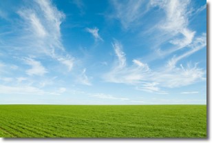
Cirrus clouds are high-level clouds that occur above 20,000 feet
and are composed mainly of ice crystals.
They are thin and wispy in appearance.
What do they indicate?
They are often the first sign of an approaching storm.
Next Topic: Condensation
Weather Topic: What are Contrails?
Home - Education - Cloud Types - Contrails
 Next Topic: Cumulonimbus Clouds
A contrail is an artificial cloud, created by the passing of an
aircraft.
Contrails form because water vapor in the exhaust of aircraft engines is suspended
in the air under certain temperatures and humidity conditions. These contrails
are called exhaust contrails.
Another type of contrail can form due to a temporary reduction in air pressure
moving over the plane's surface, causing condensation.
These are called aerodynamic contrails.
When you can see your breath on a cold day, it is also because of condensation.
The reason contrails last longer than the condensation from your breath is
because the water in contrails freezes into ice particles.
Next Topic: Cumulonimbus Clouds
Current conditions powered by WeatherAPI.com


