Weather Alert in Colorado
Red Flag Warning issued August 14 at 3:26AM MDT until August 14 at 10:00PM MDT by NWS Pueblo CO
AREAS AFFECTED: Upper Arkansas River Valley Including Lake County and Chaffee County; Fremont County Including Canon City/Howard/Texas Creek; Eastern San Juan Mountains and La Garita Mountains Including Wolf Creek Pass and Creede; Southern Front Range Including Sangre De Cristo Mountains/Wet Mountains/La Veta Pass
DESCRIPTION: ...A Red Flag Warnings remains in effect from noon through 10 PM this evening across the central, southwest and southeast mountains for dry thunderstorms... * AFFECTED AREA...Fire Weather Zones 220, 222, 223 and 225. * TIMING...From noon today to 10 PM MDT this evening. * RELATIVE HUMIDITY...As low as 15 percent. * IMPACTS...Any fire that develops will catch and spread quickly. Outdoor burning is not recommended. * Thunderstorms...Scattered high based thunderstorms will be possible this afternoon and evening. Storms will be capable of producing lightning and gusty outflow winds, with little measurable rainfall.
INSTRUCTION: A Red Flag Warning means that critical fire weather conditions are either occurring now, or will shortly. A combination of strong winds, low relative humidity, and warm temperatures can contribute to extreme fire behavior.
Want more detail? Get the Complete 7 Day and Night Detailed Forecast!
Current U.S. National Radar--Current
The Current National Weather Radar is shown below with a UTC Time (subtract 5 hours from UTC to get Eastern Time).

National Weather Forecast--Current
The Current National Weather Forecast and National Weather Map are shown below.

National Weather Forecast for Tomorrow
Tomorrow National Weather Forecast and Tomorrow National Weather Map are show below.

North America Water Vapor (Moisture)
This map shows recent moisture content over North America. Bright and colored areas show high moisture (ie, clouds); brown indicates very little moisture present; black indicates no moisture.

Weather Topic: What are Hole Punch Clouds?
Home - Education - Cloud Types - Hole Punch Clouds
 Next Topic: Mammatus Clouds
A hole punch cloud is an unusual occurrence when a disk-shaped
hole appears in a cirrostratus, cirrocumulus, or altocumulus cloud.
When part of the cloud forms ice crystals, water droplets in the surrounding area
of the cloud evaporate. The effect of this process produces a large elliptical
gap in the cloud. The hole punch cloud formation is rare, but it is not specific
to any geographic area.
Other names which have been used to describe this phenomena include fallstreak hole,
skypunch, and cloud hole.
Next Topic: Mammatus Clouds
Weather Topic: What are Nimbostratus Clouds?
Home - Education - Cloud Types - Nimbostratus Clouds
 Next Topic: Precipitation
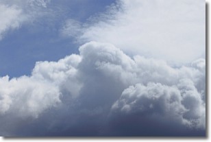
A nimbostratus cloud is similar to a stratus cloud in its formless,
smooth appearance. However, a nimbostratus cloud is darker than a stratus cloud,
because it is thicker.
Unlike a stratus cloud, a nimbostratus cloud typically brings with it the threat
of moderate to heavy precipitation. In some cases, the precipitation may evaporate
before reaching the ground, a phenomenon known as virga.
Next Topic: Precipitation
Current conditions powered by WeatherAPI.com


