Weather Alert in Utah
Red Flag Warning issued August 2 at 10:53PM MDT until August 5 at 9:00PM MDT by NWS Salt Lake City UT
AREAS AFFECTED: Southern Ashley National Forest; Tavaputs Plateau; Manti National Forest; San Rafael Swell; Central Utah West Desert; Central Utah Mountains; Henry Mountains; Color Country West Desert; Color Country Mountains; Mojave Desert; Grand Staircase
DESCRIPTION: * AFFECTED AREA...Fire Weather Zone 483 Southern Ashley National Forest, Fire Weather Zone 484 Tavaputs Plateau, Fire Weather Zone 488 Manti National Forest, Fire Weather Zone 489 San Rafael Swell, Fire Weather Zone 492 Central Utah West Desert, Fire Weather Zone 493 Central Utah Mountains, Fire Weather Zone 494 Henry Mountains, Fire Weather Zone 495 Color Country West Desert, Fire Weather Zone 496 Color Country Mountains, Fire Weather Zone 497 Mojave Desert and Fire Weather Zone 498 Grand Staircase. * WINDS...Southwest 10 to 20 mph with gusts to 25 to 35 mph both Monday and Tuesday afternoons. * RELATIVE HUMIDITY...Falling into the 5 to 9 percent range each afternoon with very poor overnight recoveries. * IMPACTS...Critical fire weather conditions are expected. Any new fire starts or existing fires may spread rapidly.
INSTRUCTION: A Red Flag Warning means that critical fire weather conditions are either occurring now...or are imminent. A combination of strong winds...low relative humidity...and warm temperatures can contribute to extreme fire behavior.
Want more detail? Get the Complete 7 Day and Night Detailed Forecast!
Current U.S. National Radar--Current
The Current National Weather Radar is shown below with a UTC Time (subtract 5 hours from UTC to get Eastern Time).

National Weather Forecast--Current
The Current National Weather Forecast and National Weather Map are shown below.

National Weather Forecast for Tomorrow
Tomorrow National Weather Forecast and Tomorrow National Weather Map are show below.

North America Water Vapor (Moisture)
This map shows recent moisture content over North America. Bright and colored areas show high moisture (ie, clouds); brown indicates very little moisture present; black indicates no moisture.

Weather Topic: What are Hole Punch Clouds?
Home - Education - Cloud Types - Hole Punch Clouds
 Next Topic: Mammatus Clouds
A hole punch cloud is an unusual occurrence when a disk-shaped
hole appears in a cirrostratus, cirrocumulus, or altocumulus cloud.
When part of the cloud forms ice crystals, water droplets in the surrounding area
of the cloud evaporate. The effect of this process produces a large elliptical
gap in the cloud. The hole punch cloud formation is rare, but it is not specific
to any geographic area.
Other names which have been used to describe this phenomena include fallstreak hole,
skypunch, and cloud hole.
Next Topic: Mammatus Clouds
Weather Topic: What are Nimbostratus Clouds?
Home - Education - Cloud Types - Nimbostratus Clouds
 Next Topic: Precipitation
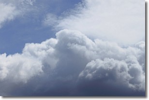
A nimbostratus cloud is similar to a stratus cloud in its formless,
smooth appearance. However, a nimbostratus cloud is darker than a stratus cloud,
because it is thicker.
Unlike a stratus cloud, a nimbostratus cloud typically brings with it the threat
of moderate to heavy precipitation. In some cases, the precipitation may evaporate
before reaching the ground, a phenomenon known as virga.
Next Topic: Precipitation
Current conditions powered by WeatherAPI.com


