Weather Alert in Georgia
Flood Warning issued April 19 at 9:16AM EDT until April 20 at 8:00AM EDT by NWS Jacksonville FL
AREAS AFFECTED: Appling, GA; Tattnall, GA; Toombs, GA; Wayne, GA
DESCRIPTION: ...The Flood Warning continues for the following rivers in Georgia... Altamaha River At Baxley affecting Wayne, Toombs, Tattnall and Appling Counties. Additional information is available at https://water.weather.gov/wfo/JAX * WHAT...Minor flooding is occurring and minor flooding is forecast. * WHERE...Altamaha River at Baxley. * WHEN...Until tomorrow morning. * IMPACTS...At 74.5 feet, Flooding of agricultural and timber lands is expected. Deens Landing and Linton Carter Landing boat ramps, picnic areas and parking lots begin to flood. At 78.0 feet, Deens Landing and Carter Linton Landing are completely flooded. Davis Landing Road, Morris Landing Road and Getaway Lane at Carters Bight Landing begin to flood. * ADDITIONAL DETAILS... - At 8:45 AM EDT Saturday the stage was 76.1 feet. - Forecast...The river is expected to fall below flood stage late tonight and continue falling to 70.2 feet Thursday morning. - Flood stage is 74.5 feet. - http://www.weather.gov/safety/flood
INSTRUCTION: N/A
Want more detail? Get the Complete 7 Day and Night Detailed Forecast!
Current U.S. National Radar--Current
The Current National Weather Radar is shown below with a UTC Time (subtract 5 hours from UTC to get Eastern Time).

National Weather Forecast--Current
The Current National Weather Forecast and National Weather Map are shown below.

National Weather Forecast for Tomorrow
Tomorrow National Weather Forecast and Tomorrow National Weather Map are show below.

North America Water Vapor (Moisture)
This map shows recent moisture content over North America. Bright and colored areas show high moisture (ie, clouds); brown indicates very little moisture present; black indicates no moisture.

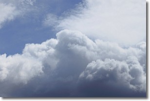
Weather Topic: What are Nimbostratus Clouds?
Home - Education - Cloud Types - Nimbostratus Clouds
 Next Topic: Precipitation
A nimbostratus cloud is similar to a stratus cloud in its formless,
smooth appearance. However, a nimbostratus cloud is darker than a stratus cloud,
because it is thicker.
Unlike a stratus cloud, a nimbostratus cloud typically brings with it the threat
of moderate to heavy precipitation. In some cases, the precipitation may evaporate
before reaching the ground, a phenomenon known as virga.
Next Topic: Precipitation
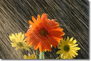
Weather Topic: What is Rain?
Home - Education - Precipitation - Rain
 Next Topic: Shelf Clouds
Precipitation in the form of water droplets is called rain.
Rain generally has a tendency to fall with less intensity over a greater period
of time, and when rainfall is more severe it is usually less sustained.
Rain is the most common form of precipitation and happens with greater frequency
depending on the season and regional influences. Cities have been shown to have
an observable effect on rainfall, due to an effect called the urban heat island.
Compared to upwind, monthly rainfall between twenty and forty miles downwind of
cities is 30% greater.
Next Topic: Shelf Clouds
Current conditions powered by WeatherAPI.com


