Weather Alert in Illinois
Special Weather Statement issued May 28 at 1:51PM CDT by NWS Lincoln IL
AREAS AFFECTED: Knox; Stark; Peoria; Marshall; Woodford; Fulton; Tazewell; McLean; Schuyler; Mason; Logan; De Witt; Piatt; Champaign; Vermilion; Cass; Menard; Scott; Morgan; Sangamon; Christian; Macon; Moultrie; Douglas; Coles; Edgar; Shelby
DESCRIPTION: Around 130 PM, media reported a funnel cloud near Delavan. Atmospheric conditions exist that favor the possible formation of cold air funnel clouds. These occur in vertically developed clouds, which usually are not associated with thunderstorms. They may persist for an extended period before dissipating. Low hanging clouds can also appear to dip up and down at times, but they will not show signs of any rapid rotation. An actual funnel cloud will exhibit spinning in a counter-clockwise direction. In rare instances these funnels may briefly touch down. Stay alert and be prepared to move to a safe shelter if a funnel cloud approaches the ground.
INSTRUCTION: N/A
Want more detail? Get the Complete 7 Day and Night Detailed Forecast!
Current U.S. National Radar--Current
The Current National Weather Radar is shown below with a UTC Time (subtract 5 hours from UTC to get Eastern Time).

National Weather Forecast--Current
The Current National Weather Forecast and National Weather Map are shown below.

National Weather Forecast for Tomorrow
Tomorrow National Weather Forecast and Tomorrow National Weather Map are show below.

North America Water Vapor (Moisture)
This map shows recent moisture content over North America. Bright and colored areas show high moisture (ie, clouds); brown indicates very little moisture present; black indicates no moisture.

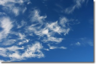
Weather Topic: What are Altostratus Clouds?
Home - Education - Cloud Types - Altostratus Clouds
 Next Topic: Cirrocumulus Clouds
Altostratus clouds form at mid to high-level altitudes
(between 2 and 7 km) and are created by a warm, stable air mass which causes
water vapor
to condense as it rise through the atmosphere. Usually altostratus clouds are
featureless sheets characterized by a uniform color.
In some cases, wind punching through the cloud formation may give it a waved
appearance, called altostratus undulatus. Altostratus clouds
are commonly seen with other cloud formations accompanying them.
Next Topic: Cirrocumulus Clouds
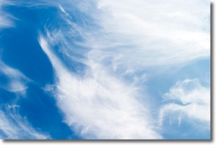
Weather Topic: What are Cirrostratus Clouds?
Home - Education - Cloud Types - Cirrostratus Clouds
 Next Topic: Cirrus Clouds
Cirrostratus clouds are high, thin clouds that form above
20,000 feet and are made mostly of ice crystals. They sometimes look like giant
feathers, horse tails, or curls of hair in the sky.
These clouds are pushed by the jet stream and can move at high speeds reaching
100 mph.
What do they indicate?
They indicate that a precipitation is likely within 24 hours.
Next Topic: Cirrus Clouds
Current conditions powered by WeatherAPI.com


