Weather Alert in Alaska
Winter Weather Advisory issued March 22 at 12:35AM AKDT until March 23 at 4:00AM AKDT by NWS Juneau AK
AREAS AFFECTED: Ketchikan Gateway Borough; Annette Island
DESCRIPTION: ...NUMEROUS SNOW SHOWERS CONTINUE THROUGH SATURDAY NIGHT, SECOND ROUND OF SNOW EXPECTED FOR THE SOUTHERN PANHANDLE BY SUNDAY AFTERNOON... .A band of snow is moving northward through the panhandle, with light to moderate snow ongoing at Skagway and Yakutat. This band will continue to move northward out of the area through early Sunday morning. In its wake, the hit or miss snow showers we have seen the previous week will return along the back side of this front with periods of light to moderate snow expected, the winter weather advisories have been extended through Sunday morning for the northern panhandle. Snow will gradually end across the northern panhandle through Sunday afternoon with longer duration advisories continuing for portions of the far southern panhandle. Snowfall accumulations will be variable across the area due to the hit or miss nature of these showers. Rates as high as 1 inch per hour and visibilities down to 1 mile or less will be possible within any heavier showers that repeatedly move over the same location. For the southern panhandle communities, temperatures are expected to start cooling through Sunday with bands of snow moving through the southern and central panhandle by the afternoon into Sunday night, prompting the longer duration Winter Weather Advisory. Accumulations in the south will be the highest on the higher elevations of Prince of Wales Island midday Sunday, but more accumulations expected at sea level by Sunday evening and night as temperatures cool through Sunday evening. * WHAT...Snow. Total snow accumulations of 2 to 5 inches. Winds gusting as high as 35 mph. Visibilities reduced to 1 mile or less. * WHERE...Ketchikan Gateway Borough and Annette Island. * WHEN...Until 4 AM AKDT Monday. * IMPACTS...Travel by land, air, and sea could be impacted. * ADDITIONAL DETAILS...Numerous snow showers will continue through Saturday night into Sunday morning. Snowfall accumulations will be variable across the area due to the hit or miss nature of these showers. A secondary system will push through the area on Sunday with higher snow accumulations initially on the higher elevations before cooling temperatures in the late afternoon and evening brings snow down to the sea level communities for Sunday night.
INSTRUCTION: Slow down and use caution while traveling. People are urged to prepare their property before the onset of winter weather. For the latest road conditions, where available, call 5 1 1 or visit 511.alaska.gov.
Want more detail? Get the Complete 7 Day and Night Detailed Forecast!
Current U.S. National Radar--Current
The Current National Weather Radar is shown below with a UTC Time (subtract 5 hours from UTC to get Eastern Time).

National Weather Forecast--Current
The Current National Weather Forecast and National Weather Map are shown below.

National Weather Forecast for Tomorrow
Tomorrow National Weather Forecast and Tomorrow National Weather Map are show below.

North America Water Vapor (Moisture)
This map shows recent moisture content over North America. Bright and colored areas show high moisture (ie, clouds); brown indicates very little moisture present; black indicates no moisture.

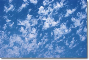
Weather Topic: What are Fractus Clouds?
Home - Education - Cloud Types - Fractus Clouds
 Next Topic: Freezing Rain
A fractus cloud (scud) is a fragmented, tattered cloud which has
likely been sheared off of another cloud. They are accessory clouds, meaning they
develop from parent clouds, and are named in a way which describes the original
cloud which contained them.
Fractus clouds which have originated from cumulus clouds are referred to as
cumulus fractus, while fractus clouds which have originated from stratus clouds
are referred to as stratus fractus. Under certain conditions a fractus cloud might
merge with another cloud, or develop into a cumulus cloud, but usually a
fractus cloud seen by itself will dissipate rapidly.
They are often observed on the leading and trailing edges of storm clouds,
and are a display of wind activity.
Next Topic: Freezing Rain
Weather Topic: What is Graupel?
Home - Education - Precipitation - Graupel
 Next Topic: Hail
Graupel is a form of precipitation that is created by atmospheric conditions
which cause supercooled water droplets to contact snow crystals and freeze to
their surface.
Sometimes known as soft hail or snow pellets, graupel is delicate and easily
destroyed by touch. Whereas hail usually falls during severe weather, graupel
doesn't require such conditions to form, and can form in mild precipitation
similar to situations which produce snowfall.
Next Topic: Hail
Current conditions powered by WeatherAPI.com


