Weather Alert in Alaska
Winter Weather Advisory issued March 22 at 12:35AM AKDT until March 22 at 10:00AM AKDT by NWS Juneau AK
AREAS AFFECTED: Haines Borough and Klukwan; Glacier Bay; Eastern Chichagof Island; Cape Fairweather to Lisianski Strait; City and Borough of Sitka; Admiralty Island; City and Borough of Juneau; Petersburg Borough; Western Kupreanof and Kuiu Island
DESCRIPTION: ...NUMEROUS SNOW SHOWERS CONTINUE THROUGH SATURDAY NIGHT, SECOND ROUND OF SNOW EXPECTED FOR THE SOUTHERN PANHANDLE BY SUNDAY AFTERNOON... .A band of snow is moving northward through the panhandle, with light to moderate snow ongoing at Skagway and Yakutat. This band will continue to move northward out of the area through early Sunday morning. In its wake, the hit or miss snow showers we have seen the previous week will return along the back side of this front with periods of light to moderate snow expected, the winter weather advisories have been extended through Sunday morning for the northern panhandle. Snow will gradually end across the northern panhandle through Sunday afternoon with longer duration advisories continuing for portions of the far southern panhandle. Snowfall accumulations will be variable across the area due to the hit or miss nature of these showers. Rates as high as 1 inch per hour and visibilities down to 1 mile or less will be possible within any heavier showers that repeatedly move over the same location. For the southern panhandle communities, temperatures are expected to start cooling through Sunday with bands of snow moving through the southern and central panhandle by the afternoon into Sunday night, prompting the longer duration Winter Weather Advisory. Accumulations in the south will be the highest on the higher elevations of Prince of Wales Island midday Sunday, but more accumulations expected at sea level by Sunday evening and night as temperatures cool through Sunday evening. * WHAT...Snow. Total snow accumulations of 2 to 5 inches. Visibilities reduced to 1 mile or less. * WHERE...Haines, Gustavus, Hoonah, Tenakee Springs, Elfin Cove, Pelican, Sitka, Angoon, Juneau, Petersburg, Kake, and Port Alexander. * WHEN...Until 10 AM AKDT this morning. * IMPACTS...Travel by land, air, and sea could be impacted. * ADDITIONAL DETAILS...Numerous snow showers will continue across the panhandle through Saturday into Sunday morning in the wake of the departing front, the Winter Weather Advisories have been extended. Snowfall accumulations will be variable across the area due to the hit or miss nature of these showers.
INSTRUCTION: Slow down and use caution while traveling. People are urged to prepare their property before the onset of winter weather. For the latest road conditions, where available, call 5 1 1 or visit 511.alaska.gov.
Want more detail? Get the Complete 7 Day and Night Detailed Forecast!
Current U.S. National Radar--Current
The Current National Weather Radar is shown below with a UTC Time (subtract 5 hours from UTC to get Eastern Time).

National Weather Forecast--Current
The Current National Weather Forecast and National Weather Map are shown below.

National Weather Forecast for Tomorrow
Tomorrow National Weather Forecast and Tomorrow National Weather Map are show below.

North America Water Vapor (Moisture)
This map shows recent moisture content over North America. Bright and colored areas show high moisture (ie, clouds); brown indicates very little moisture present; black indicates no moisture.

Weather Topic: What are Wall Clouds?
Home - Education - Cloud Types - Wall Clouds
 Next Topic: Altocumulus Clouds
A wall cloud forms underneath the base of a cumulonimbus cloud,
and can be a hotbed for deadly tornadoes.
Wall clouds are formed by air flowing into the cumulonimbus clouds, which can
result in the wall cloud descending from the base of the cumulonimbus cloud, or
rising fractus clouds which join to the base of the storm cloud as the wall cloud
takes shape.
Wall clouds can be very large, and in the Northern Hemisphere they generally
form at the southern edge of cumulonimbus clouds.
Next Topic: Altocumulus Clouds
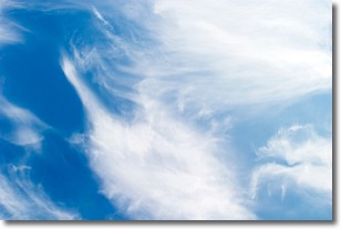
Weather Topic: What are Altostratus Clouds?
Home - Education - Cloud Types - Altostratus Clouds
 Next Topic: Cirrocumulus Clouds
Altostratus clouds form at mid to high-level altitudes
(between 2 and 7 km) and are created by a warm, stable air mass which causes
water vapor
to condense as it rise through the atmosphere. Usually altostratus clouds are
featureless sheets characterized by a uniform color.
In some cases, wind punching through the cloud formation may give it a waved
appearance, called altostratus undulatus. Altostratus clouds
are commonly seen with other cloud formations accompanying them.
Next Topic: Cirrocumulus Clouds
Current conditions powered by WeatherAPI.com


