Weather Alert in Missouri
Special Weather Statement issued August 11 at 8:00PM CDT by NWS Kansas City/Pleasant Hill MO
AREAS AFFECTED: Lafayette; Saline; Johnson; Pettis
DESCRIPTION: At 800 PM CDT, Doppler radar was tracking strong thunderstorms along a line extending from near Knob Noster to La Monte to 7 miles north of Sedalia. Movement was north at 40 mph. HAZARD...Wind gusts between 40-45 mph. SOURCE...Radar indicated. IMPACT...Gusty winds could knock down tree limbs and blow around unsecured objects. Locations impacted include... Concordia, Sweet Springs, Alma, Houstonia, Emma, and Hughesville. This includes Interstate 70 in Missouri between mile markers 58 and 84.
INSTRUCTION: If outdoors, consider seeking shelter inside a building. Torrential rainfall is also occurring with these storms and may lead to localized flooding. Do not drive your vehicle through flooded roadways. Frequent cloud to ground lightning is occurring with these storms. Lightning can strike 10 miles away from a thunderstorm. Seek a safe shelter inside a building or vehicle.
Want more detail? Get the Complete 7 Day and Night Detailed Forecast!
Current U.S. National Radar--Current
The Current National Weather Radar is shown below with a UTC Time (subtract 5 hours from UTC to get Eastern Time).

National Weather Forecast--Current
The Current National Weather Forecast and National Weather Map are shown below.

National Weather Forecast for Tomorrow
Tomorrow National Weather Forecast and Tomorrow National Weather Map are show below.

North America Water Vapor (Moisture)
This map shows recent moisture content over North America. Bright and colored areas show high moisture (ie, clouds); brown indicates very little moisture present; black indicates no moisture.

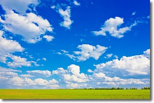
Weather Topic: What are Cumulus Clouds?
Home - Education - Cloud Types - Cumulus Clouds
 Next Topic: Drizzle
Cumulus clouds are fluffy and textured with rounded tops, and
may have flat bottoms. The border of a cumulus cloud
is clearly defined, and can have the appearance of cotton or cauliflower.
Cumulus clouds form at low altitudes (rarely above 2 km) but can grow very tall,
becoming cumulus congestus and possibly the even taller cumulonimbus clouds.
When cumulus clouds become taller, they have a greater chance of producing precipitation.
Next Topic: Drizzle
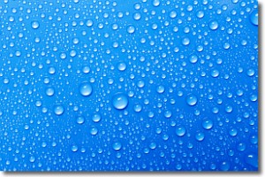
Weather Topic: What is Evaporation?
Home - Education - Precipitation - Evaporation
 Next Topic: Fog
Evaporation is the process which returns water from the earth
back to the atmosphere, and is another crucial process in the water cycle.
Evaporation is the transformation of liquid into gas, and it happens because
molecules are excited by the application of energy and turn into vapor.
In order for water to evaporate it has to be on the surface of a body of water.
Next Topic: Fog
Current conditions powered by WeatherAPI.com


