Weather Alert in Alaska
Special Weather Statement issued August 25 at 4:29PM AKDT by NWS Anchorage AK
AREAS AFFECTED: Bristol Bay Borough (Naknek and King Salmon); Lake Iliamna / Nila Vena / Nanvarpak
DESCRIPTION: Strong southwesterly winds up to 45 mph have resulted in the resuspension of ash from the 1912 Katmai-Novarupta eruption across central Lake and Peninsula Borough and could work into eastern Bristol Bay Borough. Communities in central Lake and Peninsula Borough, including Igiugig, may observe reduced visibility as a result of the ash. Resuspended ash may work into eastern Bristol Bay Borough, and the communities of King Salmon and Naknek may see hazy conditions. Those with respiratory ailments in these areas are encouraged to avoid or reduce outdoor activity to avoid inhaling the ash. Rain begins to move into the region Tuesday which should allow ash impacts to cease by Tuesday night.
INSTRUCTION: N/A
Want more detail? Get the Complete 7 Day and Night Detailed Forecast!
Current U.S. National Radar--Current
The Current National Weather Radar is shown below with a UTC Time (subtract 5 hours from UTC to get Eastern Time).

National Weather Forecast--Current
The Current National Weather Forecast and National Weather Map are shown below.

National Weather Forecast for Tomorrow
Tomorrow National Weather Forecast and Tomorrow National Weather Map are show below.

North America Water Vapor (Moisture)
This map shows recent moisture content over North America. Bright and colored areas show high moisture (ie, clouds); brown indicates very little moisture present; black indicates no moisture.

Weather Topic: What are Wall Clouds?
Home - Education - Cloud Types - Wall Clouds
 Next Topic: Altocumulus Clouds
A wall cloud forms underneath the base of a cumulonimbus cloud,
and can be a hotbed for deadly tornadoes.
Wall clouds are formed by air flowing into the cumulonimbus clouds, which can
result in the wall cloud descending from the base of the cumulonimbus cloud, or
rising fractus clouds which join to the base of the storm cloud as the wall cloud
takes shape.
Wall clouds can be very large, and in the Northern Hemisphere they generally
form at the southern edge of cumulonimbus clouds.
Next Topic: Altocumulus Clouds
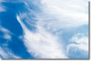
Weather Topic: What are Altostratus Clouds?
Home - Education - Cloud Types - Altostratus Clouds
 Next Topic: Cirrocumulus Clouds
Altostratus clouds form at mid to high-level altitudes
(between 2 and 7 km) and are created by a warm, stable air mass which causes
water vapor
to condense as it rise through the atmosphere. Usually altostratus clouds are
featureless sheets characterized by a uniform color.
In some cases, wind punching through the cloud formation may give it a waved
appearance, called altostratus undulatus. Altostratus clouds
are commonly seen with other cloud formations accompanying them.
Next Topic: Cirrocumulus Clouds
Current conditions powered by WeatherAPI.com


