Weather Alert in Oregon
Flash Flood Warning issued August 3 at 4:37PM PDT until August 3 at 7:45PM PDT by NWS Boise ID
AREAS AFFECTED: Baker, OR; Malheur, OR
DESCRIPTION: FFWBOI The National Weather Service in Boise has issued a * Flash Flood Warning for... The Cow Valley and Durkee Burn Scar in... South Central Baker County in northeastern Oregon... North Central Malheur County in southeastern Oregon... * Until 745 PM PDT /845 PM MDT/. * At 437 PM PDT /537 PM MDT/, Doppler radar indicated thunderstorms producing heavy rain over the Cow Valley and Durkee Burn Scars. Between 0.5 and 1 inch of rain has fallen. Flash flooding is ongoing or expected to begin shortly. HAZARD...Life threatening flash flooding. Thunderstorms producing flash flooding in and around the Cow Valley and Durkee Burn Scars. SOURCE...Radar. IMPACT...Life threatening flash flooding of areas in and around the Cow Valley and Durkee Burn Scar. * Some locations that will experience flash flooding include... Brogan, Huntington, California Mountain, Brogan Hill Summit, Rye Valley, Malheur Reservoir, Brosman Mountain, Lime, Malheur City, Weatherby and Sugarloaf Butte.
INSTRUCTION: This is a life threatening situation. Heavy rainfall will cause extensive and severe flash flooding of creeks...streams...and ditches in the Cow Valley and Durkee Burn Scar. Severe debris flows can also be anticipated across roads. Roads and driveways may be washed away in places. If you encounter flood waters...climb to safety. Move away from recently burned areas. Life-threatening flooding of creeks, roads and normally dry washes is likely. The heavy rains will likely trigger rockslides, mudslides and debris flows in steep terrain, especially in and around these areas. Please report observed flooding to local emergency services or law enforcement and request they pass this information to the National Weather Service when you can do so safely.
Want more detail? Get the Complete 7 Day and Night Detailed Forecast!
Current U.S. National Radar--Current
The Current National Weather Radar is shown below with a UTC Time (subtract 5 hours from UTC to get Eastern Time).

National Weather Forecast--Current
The Current National Weather Forecast and National Weather Map are shown below.

National Weather Forecast for Tomorrow
Tomorrow National Weather Forecast and Tomorrow National Weather Map are show below.

North America Water Vapor (Moisture)
This map shows recent moisture content over North America. Bright and colored areas show high moisture (ie, clouds); brown indicates very little moisture present; black indicates no moisture.

Weather Topic: What are Mammatus Clouds?
Home - Education - Cloud Types - Mammatus Clouds
 Next Topic: Nimbostratus Clouds
A mammatus cloud is a cloud with a unique feature which resembles
a web of pouches hanging along the base of the cloud.
In the United States, mammatus clouds tend to form in the warmer months, commonly
in the Midwest and eastern regions.
While they usually form at the bottom of a cumulonimbis cloud, they can also form
under altostratus, altocumulus, stratocumulus, and cirrus clouds. Mammatus clouds
warn that severe weather is close.
Next Topic: Nimbostratus Clouds
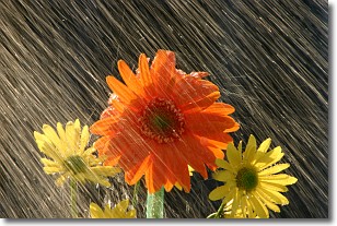
Weather Topic: What is Precipitation?
Home - Education - Precipitation - Precipitation
 Next Topic: Rain
Precipitation can refer to many different forms of water that
may fall from clouds. Precipitation occurs after a cloud has become saturated to
the point where its water particles are more dense than the air below the cloud.
In most cases, precipitation will reach the ground, but it is not uncommon for
precipitation to evaporate before it reaches the earth's surface.
When precipitation evaporates before it contacts the ground it is called Virga.
Graupel, hail, sleet, rain, drizzle, and snow are forms of precipitation, but fog
and mist are not considered precipitation because the water vapor which
constitutes them isn't dense enough to fall to the ground.
Next Topic: Rain
Current conditions powered by WeatherAPI.com


