Weather Alert in Oregon
Red Flag Warning issued September 5 at 1:38PM MDT until September 5 at 10:00PM MDT by NWS Boise ID
AREAS AFFECTED: Steens Mountain; Southern Grasslands
DESCRIPTION: ...RED FLAG WARNING FOR SOUTHEAST OREGON DUE TO ABUNDANT LIGHTNING AND GUSTY THUNDERSTORM OUTFLOWS THIS AFTERNOON AND EVENING... .Scattered thunderstorms capable of producing abundant lightning are forecast Friday afternoon and evening over southeastern Oregon. Gusty outflows to 50 mph may continue well into the evening and travel a large distance away from thunderstorms. The National Weather Service in Boise has issued a Red Flag Warning for lightning, which is in effect until 9 PM PDT this evening. * AFFECTED AREA...In Oregon, Fire Weather Zones 671 Steens Mountain and 672 Southern Grasslands. * TIMING...Until 9 PM PDT this evening. * THUNDERSTORMS...Scattered coverage with abundant lightning. * OUTFLOW WINDS...Gusty erratic winds up to 50 MPH. * IMPACTS...Any fire that develops will catch and spread quickly. Outdoor burning is not recommended.
INSTRUCTION: A Red Flag Warning means that critical fire weather conditions are either occurring now, or will occur shortly.
Want more detail? Get the Complete 7 Day and Night Detailed Forecast!
Current U.S. National Radar--Current
The Current National Weather Radar is shown below with a UTC Time (subtract 5 hours from UTC to get Eastern Time).

National Weather Forecast--Current
The Current National Weather Forecast and National Weather Map are shown below.

National Weather Forecast for Tomorrow
Tomorrow National Weather Forecast and Tomorrow National Weather Map are show below.

North America Water Vapor (Moisture)
This map shows recent moisture content over North America. Bright and colored areas show high moisture (ie, clouds); brown indicates very little moisture present; black indicates no moisture.

Weather Topic: What are Mammatus Clouds?
Home - Education - Cloud Types - Mammatus Clouds
 Next Topic: Nimbostratus Clouds
A mammatus cloud is a cloud with a unique feature which resembles
a web of pouches hanging along the base of the cloud.
In the United States, mammatus clouds tend to form in the warmer months, commonly
in the Midwest and eastern regions.
While they usually form at the bottom of a cumulonimbis cloud, they can also form
under altostratus, altocumulus, stratocumulus, and cirrus clouds. Mammatus clouds
warn that severe weather is close.
Next Topic: Nimbostratus Clouds
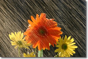
Weather Topic: What is Precipitation?
Home - Education - Precipitation - Precipitation
 Next Topic: Rain
Precipitation can refer to many different forms of water that
may fall from clouds. Precipitation occurs after a cloud has become saturated to
the point where its water particles are more dense than the air below the cloud.
In most cases, precipitation will reach the ground, but it is not uncommon for
precipitation to evaporate before it reaches the earth's surface.
When precipitation evaporates before it contacts the ground it is called Virga.
Graupel, hail, sleet, rain, drizzle, and snow are forms of precipitation, but fog
and mist are not considered precipitation because the water vapor which
constitutes them isn't dense enough to fall to the ground.
Next Topic: Rain
Current conditions powered by WeatherAPI.com


