Weather Alert in Wisconsin
Air Quality Alert issued August 1 at 10:23AM CDT by NWS Duluth MN
AREAS AFFECTED: Douglas; Bayfield; Ashland; Iron; Burnett; Washburn; Sawyer; Price
DESCRIPTION: The Wisconsin Department of Natural Resources has issued an Air Quality Advisory for the following counties: Ashland, Bayfield, Burnett, Douglas, Iron, Price, Sawyer, Washburn. WHAT...The PM2.5 AQI is expected to reach the Unhealthy for Sensitive Groups to Unhealthy level. WHERE...All of Wisconsin WHEN...Until noon Saturday, August 2 Precautionary/Preparedness Actions: Sensitive groups: Consider rescheduling or moving all activities inside. Go inside if you have symptoms. People with asthma: Follow your asthma action plan and keep quick-relief medicine handy. People with heart disease: Symptoms such as palpitations, shortness of breath, or unusual fatigue may indicate a serious problem. If you have any of these, contact your health care provider. Everyone else: Keep outdoor activities shorter and less intense. Go inside if you have symptoms. Additional Details: Canadian wildfire smoke will continue to impact Wisconsin`s surface air quality over the next several days. Conditions have improved since Thursday as a pocket of cleaner air has infiltrated the widespread blanket of dense smoke across eastern Wisconsin. However, a mix of Unhealthy for Sensitive Groups (USG; Orange) AQI and Unhealthy (Red) AQI is still expected today, with locations farther north more likely to see heavier smoke. Continued gradual improvement is currently anticipated heading into the weekend, but USG (Orange) AQI to Unhealthy (Red) AQI will remain possible. Conditions will continue to be reevaluated on a day-to-day basis, including updates to the forecast and any associated Air Quality Advisories. For more information on current air quality, please see: https://airquality.wi.gov
INSTRUCTION: N/A
Want more detail? Get the Complete 7 Day and Night Detailed Forecast!
Current U.S. National Radar--Current
The Current National Weather Radar is shown below with a UTC Time (subtract 5 hours from UTC to get Eastern Time).

National Weather Forecast--Current
The Current National Weather Forecast and National Weather Map are shown below.

National Weather Forecast for Tomorrow
Tomorrow National Weather Forecast and Tomorrow National Weather Map are show below.

North America Water Vapor (Moisture)
This map shows recent moisture content over North America. Bright and colored areas show high moisture (ie, clouds); brown indicates very little moisture present; black indicates no moisture.

Weather Topic: What are Mammatus Clouds?
Home - Education - Cloud Types - Mammatus Clouds
 Next Topic: Nimbostratus Clouds
A mammatus cloud is a cloud with a unique feature which resembles
a web of pouches hanging along the base of the cloud.
In the United States, mammatus clouds tend to form in the warmer months, commonly
in the Midwest and eastern regions.
While they usually form at the bottom of a cumulonimbis cloud, they can also form
under altostratus, altocumulus, stratocumulus, and cirrus clouds. Mammatus clouds
warn that severe weather is close.
Next Topic: Nimbostratus Clouds
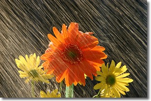
Weather Topic: What is Precipitation?
Home - Education - Precipitation - Precipitation
 Next Topic: Rain
Precipitation can refer to many different forms of water that
may fall from clouds. Precipitation occurs after a cloud has become saturated to
the point where its water particles are more dense than the air below the cloud.
In most cases, precipitation will reach the ground, but it is not uncommon for
precipitation to evaporate before it reaches the earth's surface.
When precipitation evaporates before it contacts the ground it is called Virga.
Graupel, hail, sleet, rain, drizzle, and snow are forms of precipitation, but fog
and mist are not considered precipitation because the water vapor which
constitutes them isn't dense enough to fall to the ground.
Next Topic: Rain
Current conditions powered by WeatherAPI.com


