Weather Alert in New York
Special Weather Statement issued September 3 at 3:13PM EDT by NWS Albany NY
AREAS AFFECTED: Northern Saratoga; Northern Warren; Northern Washington; Western Schenectady; Eastern Schenectady; Southern Saratoga; Western Albany; Eastern Albany; Western Rensselaer; Eastern Rensselaer; Eastern Greene; Western Columbia; Eastern Columbia; Eastern Ulster; Western Dutchess; Eastern Dutchess; Southeast Warren; Southern Washington
DESCRIPTION: The combination of recent dry weather and increasing drought, southerly winds gusting between 25 and 35 mph and relative humidity values between 35 and 40 percent will contribute to an elevated risk for fire spread tomorrow. The risk will be greatest across portions of the Hudson Valley Fire Danger Rating Area which includes the following counties: Warren, Saratoga, Washington, Schenectady, Albany, Rensselaer, Columbia, Dutchess, eastern Greene and eastern Ulster counties. Any fires that develop in these areas could spread rapidly. Residents are encouraged to exercise caution if handling any potential ignition sources, such as machinery, cigarettes, or matches. For more information about wildfire danger and wildfire prevention, please visit the New York Department of Environmental Conservation website at http://dec.ny.gov/environmental- protection/wildfires.
INSTRUCTION: N/A
Want more detail? Get the Complete 7 Day and Night Detailed Forecast!
Current U.S. National Radar--Current
The Current National Weather Radar is shown below with a UTC Time (subtract 5 hours from UTC to get Eastern Time).

National Weather Forecast--Current
The Current National Weather Forecast and National Weather Map are shown below.

National Weather Forecast for Tomorrow
Tomorrow National Weather Forecast and Tomorrow National Weather Map are show below.

North America Water Vapor (Moisture)
This map shows recent moisture content over North America. Bright and colored areas show high moisture (ie, clouds); brown indicates very little moisture present; black indicates no moisture.

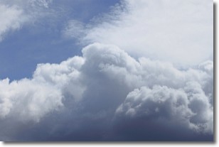
Weather Topic: What are Nimbostratus Clouds?
Home - Education - Cloud Types - Nimbostratus Clouds
 Next Topic: Precipitation
A nimbostratus cloud is similar to a stratus cloud in its formless,
smooth appearance. However, a nimbostratus cloud is darker than a stratus cloud,
because it is thicker.
Unlike a stratus cloud, a nimbostratus cloud typically brings with it the threat
of moderate to heavy precipitation. In some cases, the precipitation may evaporate
before reaching the ground, a phenomenon known as virga.
Next Topic: Precipitation
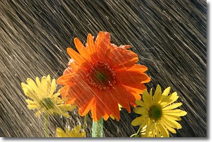
Weather Topic: What is Rain?
Home - Education - Precipitation - Rain
 Next Topic: Shelf Clouds
Precipitation in the form of water droplets is called rain.
Rain generally has a tendency to fall with less intensity over a greater period
of time, and when rainfall is more severe it is usually less sustained.
Rain is the most common form of precipitation and happens with greater frequency
depending on the season and regional influences. Cities have been shown to have
an observable effect on rainfall, due to an effect called the urban heat island.
Compared to upwind, monthly rainfall between twenty and forty miles downwind of
cities is 30% greater.
Next Topic: Shelf Clouds
Current conditions powered by WeatherAPI.com


