Weather Alert in Kentucky
Special Weather Statement issued September 5 at 11:41PM EDT by NWS Jackson KY
AREAS AFFECTED: Morgan; Johnson; Magoffin; Floyd; Knott; Martin; Pike
DESCRIPTION: At 1141 PM EDT, Doppler radar was tracking strong thunderstorms along a line extending from Dingus to Riceville to near Vail. Movement was northeast at 55 mph. HAZARD...Wind gusts up to 50 mph. SOURCE...Radar indicated. IMPACT...Gusty winds could knock down tree limbs and blow around unsecured objects. Locations impacted include... Paintsville, Prestonsburg, Inez, Martin, Warfield, Allen, Pilgrim, Oaklawn Estates, Davella, Lancer, Falcon, Whitehouse, Piso, Collista, West Van Lear, Williamsport, Blue River, Milo, Jarad, and Gillem Branch. THIS INCLUDES THE FOLLOWING HIGHWAYS... Kentucky Highway 3 in Floyd County between mile markers 1 and 4. Kentucky Highway 3 in Johnson County Kentucky Highway 3 in Martin County between mile markers 1 and 9. Kentucky Highway 80 in Floyd County between mile markers 4 and 14. U.S. Highway 23 in Floyd County between mile markers 2 and 21. U.S. Highway 23 in Johnson County between mile markers 0 and 16.
INSTRUCTION: If outdoors, consider seeking shelter inside a building. Torrential rainfall is also occurring with these storms and may lead to localized flooding. Do not drive your vehicle through flooded roadways. A Severe Thunderstorm Watch remains in effect until 100 AM EDT for southeastern and northeastern Kentucky.
Want more detail? Get the Complete 7 Day and Night Detailed Forecast!
Current U.S. National Radar--Current
The Current National Weather Radar is shown below with a UTC Time (subtract 5 hours from UTC to get Eastern Time).

National Weather Forecast--Current
The Current National Weather Forecast and National Weather Map are shown below.

National Weather Forecast for Tomorrow
Tomorrow National Weather Forecast and Tomorrow National Weather Map are show below.

North America Water Vapor (Moisture)
This map shows recent moisture content over North America. Bright and colored areas show high moisture (ie, clouds); brown indicates very little moisture present; black indicates no moisture.

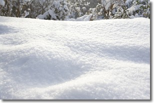
Weather Topic: What is Snow?
Home - Education - Precipitation - Snow
 Next Topic: Stratocumulus Clouds
Snow is precipitation taking the form of ice crystals. Each ice crystal, or snowflake,
has unique characteristics, but all of them grow in a hexagonal structure.
Snowfall can last for sustained periods of time and result in significant buildup
of snow on the ground.
On the earth's surface, snow starts out light and powdery, but as it begins to melt
it tends to become more granular, producing small bits of ice which have the consistency of
sand. After several cycles of melting and freezing, snow can become very dense
and ice-like, commonly known as snow pack.
Next Topic: Stratocumulus Clouds
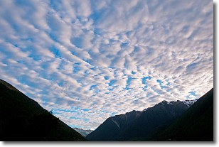
Weather Topic: What are Stratus Clouds?
Home - Education - Cloud Types - Stratus Clouds
 Next Topic: Wall Clouds
Stratus clouds are similar to altostratus clouds, but form at a
lower altitude and are identified by their fog-like appearance, lacking the
distinguishing features of most clouds.
Stratus clouds are wider than most clouds, and their base has a smooth, uniform
look which is lighter in color than a nimbostratus cloud.
The presence of a stratus cloud indicates the possibility of minor precipitation,
such as drizzle, but heavier precipitation does not typically arrive in the form
of a stratus cloud.
Next Topic: Wall Clouds
Current conditions powered by WeatherAPI.com


