Weather Alert in California
Flood Warning issued February 24 at 8:04PM PST until February 25 at 6:00PM PST by NWS Eureka CA
AREAS AFFECTED: Humboldt, CA
DESCRIPTION: ...Forecast flooding changed from Minor to Moderate severity and increased in duration for the following rivers in California... Eel River at Fernbridge affecting Humboldt County. For the Eel River...including Fernbridge...Moderate flooding is forecast. * WHAT...Moderate flooding is forecast. * WHERE...Eel River at Fernbridge. * WHEN...Until Wednesday evening. * IMPACTS...At 22.0 feet, The western half of the Eel Delta may be completely flooded, especially if at or above this level for an extended period of time. This includes areas northwest of Loleta and Cannibal Island Road. A Special Action Advisory is being issued to all owners of livestock in low-lying areas of the Eel River Delta. Owners of livestock should take appropriate action to protect their animals. At 24.0 feet, Minor flooding of Highway 211 to Ferndale south of Fernbridge. Much of the Eel Delta may be flooded, including areas northwest of Loleta and the western portion of Cannibal Island Road. Flooding will be enhanced for longer duration events. A Special Action Advisory is being issued to all owners of livestock in all low-lying areas adjacent to the Eel River. Appropriate action should be taken to protect livestock. * ADDITIONAL DETAILS... - At 7:15 PM PST Tuesday the stage was 17.8 feet. - Bankfull stage is 20.0 feet. - Forecast...The river is expected to rise above flood stage late this evening to a crest of 23.4 feet tomorrow morning. It will then fall below flood stage tomorrow afternoon. - Flood stage is 20.0 feet. - Flood History...This crest compares to a previous crest of 23.5 feet on 01/21/1993. - http://www.weather.gov/safety/flood
INSTRUCTION: Turn around, don't drown when encountering flooded roads. Most flood deaths occur in vehicles. Motorists should not attempt to drive around barricades or drive cars through flooded areas. Stay tuned to further developments by listening to your local radio, television, or NOAA Weather Radio for further information. Be especially cautious at night when it is harder to recognize the dangers of flooding. This warning will be in effect until the river falls below its flood stage. Please report observed flooding to local emergency services or law enforcement and request they pass this information to the National Weather Service when you can do so safely. Additional information is available at weather.gov/eka. The next statement will be issued Wednesday morning at 815 AM PST.
Want more detail? Get the Complete 7 Day and Night Detailed Forecast!
Current U.S. National Radar--Current
The Current National Weather Radar is shown below with a UTC Time (subtract 5 hours from UTC to get Eastern Time).

National Weather Forecast--Current
The Current National Weather Forecast and National Weather Map are shown below.

National Weather Forecast for Tomorrow
Tomorrow National Weather Forecast and Tomorrow National Weather Map are show below.

North America Water Vapor (Moisture)
This map shows recent moisture content over North America. Bright and colored areas show high moisture (ie, clouds); brown indicates very little moisture present; black indicates no moisture.

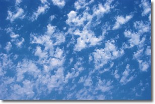
Weather Topic: What are Fractus Clouds?
Home - Education - Cloud Types - Fractus Clouds
 Next Topic: Freezing Rain
A fractus cloud (scud) is a fragmented, tattered cloud which has
likely been sheared off of another cloud. They are accessory clouds, meaning they
develop from parent clouds, and are named in a way which describes the original
cloud which contained them.
Fractus clouds which have originated from cumulus clouds are referred to as
cumulus fractus, while fractus clouds which have originated from stratus clouds
are referred to as stratus fractus. Under certain conditions a fractus cloud might
merge with another cloud, or develop into a cumulus cloud, but usually a
fractus cloud seen by itself will dissipate rapidly.
They are often observed on the leading and trailing edges of storm clouds,
and are a display of wind activity.
Next Topic: Freezing Rain
Weather Topic: What is Graupel?
Home - Education - Precipitation - Graupel
 Next Topic: Hail
Graupel is a form of precipitation that is created by atmospheric conditions
which cause supercooled water droplets to contact snow crystals and freeze to
their surface.
Sometimes known as soft hail or snow pellets, graupel is delicate and easily
destroyed by touch. Whereas hail usually falls during severe weather, graupel
doesn't require such conditions to form, and can form in mild precipitation
similar to situations which produce snowfall.
Next Topic: Hail
Current conditions powered by WeatherAPI.com


