Weather Alert in North Carolina
Flood Advisory issued August 11 at 1:26PM EDT until August 11 at 7:15PM EDT by NWS Greenville-Spartanburg SC
AREAS AFFECTED: Gaston, NC
DESCRIPTION: * WHAT...Flooding caused by excessive rainfall is expected. * WHERE...A portion of piedmont North Carolina, including the following county, Gaston. * WHEN...Until 415 PM EDT. * IMPACTS...Nuisance flooding of low-lying areas adjacent to streams and other poor-drainage areas, including farmland, parks, greenways, boat-access areas, golf courses, underpasses, and parking lots. Isolated, shallow flows over roadways is possible. A few flood-prone, low-water crossings may become impassible. A small culvert washout or two is possible. * ADDITIONAL DETAILS... - At 109 PM EDT, Doppler radar and automated rain gauges indicate heavy rainfall is gradually tapering off from south to north from Crowders to Gastonia, Ranlo, and Dallas across central and southern Gaston County. However, rainfall totals of 1-2 inches have been observed over the past 30-45 minutes, which is heavy enough to result in excessive runoff and rapidly rising smaller streams. Developing areas of nuisance flooding, especially within the city of Gastonia, are possible over the next 60 minutes. Areas of greatest concern include, but are not limited to: 1) Catawba Creek from W Garrison Blvd to S Marietta St to Ferguson Park and the Catawba Creek Golf Course, to Union Rd and Fern Forest Dr along the Catawba Creek Greenway. 2) Blackwood Creek near All American Park and from S Linwood Rd to Old West Ln to Davis Park Rd. 3) Kaglor Branch near W Davidson Ave, Tulip Dr, and Rankin Lake Park. - Moderate to heavy rainfall is expected to persist for the next 15 minutes before tapering off. This may result in another half-inch to inch of rainfall. However, additional moderate to heavy rainfall is possible into the later afternoon hours. Given antecedent conditions, if additional rainfall develops, more significant flash flooding may occur and a Flash Flood Warning may be issued. Caution is advised near any stream or other vulnerable area. Seek higher ground immediately if heavy rain develops. Please have a plan in place should flash flooding develop and do not hesitate to act. - Some locations that may experience nuisance flooding include... Gastonia, Bessemer City, South Gastonia, Dallas, Cramerton, Lowell, Ranlo, Lake Wylie and Crowders. - Http://www.weather.gov/safety/flood
INSTRUCTION: Move to higher ground now. Act quickly to protect your life. Be aware of your surroundings and do not drive on flooded roads. Stay away or be swept away. River banks and culverts can become unstable and unsafe.
Want more detail? Get the Complete 7 Day and Night Detailed Forecast!
Current U.S. National Radar--Current
The Current National Weather Radar is shown below with a UTC Time (subtract 5 hours from UTC to get Eastern Time).

National Weather Forecast--Current
The Current National Weather Forecast and National Weather Map are shown below.

National Weather Forecast for Tomorrow
Tomorrow National Weather Forecast and Tomorrow National Weather Map are show below.

North America Water Vapor (Moisture)
This map shows recent moisture content over North America. Bright and colored areas show high moisture (ie, clouds); brown indicates very little moisture present; black indicates no moisture.

Weather Topic: What are Mammatus Clouds?
Home - Education - Cloud Types - Mammatus Clouds
 Next Topic: Nimbostratus Clouds
A mammatus cloud is a cloud with a unique feature which resembles
a web of pouches hanging along the base of the cloud.
In the United States, mammatus clouds tend to form in the warmer months, commonly
in the Midwest and eastern regions.
While they usually form at the bottom of a cumulonimbis cloud, they can also form
under altostratus, altocumulus, stratocumulus, and cirrus clouds. Mammatus clouds
warn that severe weather is close.
Next Topic: Nimbostratus Clouds
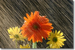
Weather Topic: What is Precipitation?
Home - Education - Precipitation - Precipitation
 Next Topic: Rain
Precipitation can refer to many different forms of water that
may fall from clouds. Precipitation occurs after a cloud has become saturated to
the point where its water particles are more dense than the air below the cloud.
In most cases, precipitation will reach the ground, but it is not uncommon for
precipitation to evaporate before it reaches the earth's surface.
When precipitation evaporates before it contacts the ground it is called Virga.
Graupel, hail, sleet, rain, drizzle, and snow are forms of precipitation, but fog
and mist are not considered precipitation because the water vapor which
constitutes them isn't dense enough to fall to the ground.
Next Topic: Rain
Current conditions powered by WeatherAPI.com


