Weather Alert in Georgia
Flood Warning issued August 2 at 6:43PM EDT until August 2 at 8:15PM EDT by NWS Charleston SC
AREAS AFFECTED: Chatham, GA
DESCRIPTION: * WHAT...Flooding caused by excessive rainfall is expected. * WHERE...A portion of southeast Georgia, including the following county, Chatham. * WHEN...Until 815 PM EDT. * IMPACTS...Expect many areas of slow moving or standing water. * ADDITIONAL DETAILS... - At 641 PM EDT, Doppler radar indicated only light rain falling over central Chatham County. While no additional flash flooding is expected, many areas remain flooded around the Windsor Forest, Hunter Army Airfield and Downtown Savannah areas. It will take a bit longer for flood waters to recede. Remember, never drive into flooded areas! - Some locations that will experience flooding include... Windsor Forest, Hunter Army Airfield, Coffee Bluff, Midtown Savannah, Downtown Savannah, Montgomery, Garden City, Thunderbolt and Vernonburg. - This includes the following highways... I-16 near mile marker 162. I-95 in Georgia between mile markers 96 and 97. I-516 between mile markers 3 and 4.
INSTRUCTION: Turn around, don't drown when encountering flooded roads. Most flood deaths occur in vehicles.
Want more detail? Get the Complete 7 Day and Night Detailed Forecast!
Current U.S. National Radar--Current
The Current National Weather Radar is shown below with a UTC Time (subtract 5 hours from UTC to get Eastern Time).

National Weather Forecast--Current
The Current National Weather Forecast and National Weather Map are shown below.

National Weather Forecast for Tomorrow
Tomorrow National Weather Forecast and Tomorrow National Weather Map are show below.

North America Water Vapor (Moisture)
This map shows recent moisture content over North America. Bright and colored areas show high moisture (ie, clouds); brown indicates very little moisture present; black indicates no moisture.

Weather Topic: What are Mammatus Clouds?
Home - Education - Cloud Types - Mammatus Clouds
 Next Topic: Nimbostratus Clouds
A mammatus cloud is a cloud with a unique feature which resembles
a web of pouches hanging along the base of the cloud.
In the United States, mammatus clouds tend to form in the warmer months, commonly
in the Midwest and eastern regions.
While they usually form at the bottom of a cumulonimbis cloud, they can also form
under altostratus, altocumulus, stratocumulus, and cirrus clouds. Mammatus clouds
warn that severe weather is close.
Next Topic: Nimbostratus Clouds
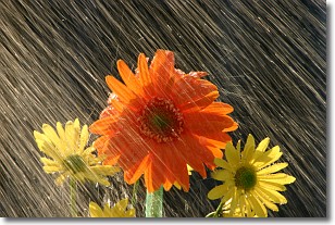
Weather Topic: What is Precipitation?
Home - Education - Precipitation - Precipitation
 Next Topic: Rain
Precipitation can refer to many different forms of water that
may fall from clouds. Precipitation occurs after a cloud has become saturated to
the point where its water particles are more dense than the air below the cloud.
In most cases, precipitation will reach the ground, but it is not uncommon for
precipitation to evaporate before it reaches the earth's surface.
When precipitation evaporates before it contacts the ground it is called Virga.
Graupel, hail, sleet, rain, drizzle, and snow are forms of precipitation, but fog
and mist are not considered precipitation because the water vapor which
constitutes them isn't dense enough to fall to the ground.
Next Topic: Rain
Current conditions powered by WeatherAPI.com


