Weather Alert in Texas
Flood Advisory issued September 5 at 2:51PM CDT until September 5 at 6:00PM CDT by NWS San Angelo TX
AREAS AFFECTED: Tom Green, TX
DESCRIPTION: * WHAT...Urban and small stream flooding caused by excessive rainfall is expected. * WHERE...A portion of west central Texas, including the following county, Tom Green. * WHEN...Until 600 PM CDT. * IMPACTS...Minor flooding in low-lying and poor drainage areas. * ADDITIONAL DETAILS... - At 248 PM CDT, Doppler radar indicated heavy rain due to thunderstorms. There has been a report of minor street flooding in San Angelo. This will cause urban and small stream flooding. Around 1 inch has fallen and additional rainfall is expected. - Some locations that will experience flooding include... San Angelo, Lake Nasworthy, Goodfellow Air Force Base, O.C. Fisher Reservoir and San Angelo State Park. - This includes the following Low Water Crossings... College Hills and Millbrook, Southwest Blvd and Loop 306, Howard and Webster, Jackson From Knickerbocker to South Bryant, Parkwood and Lindenwood, 1500 Block of Spaulding, Sul Ross At Red Arroyo Crossing, Huntington and Sunset, Huntington and Sunset and 300 block of North Archer. - http://www.weather.gov/safety/flood
INSTRUCTION: Turn around, don't drown when encountering flooded roads. Most flood deaths occur in vehicles.
Want more detail? Get the Complete 7 Day and Night Detailed Forecast!
Current U.S. National Radar--Current
The Current National Weather Radar is shown below with a UTC Time (subtract 5 hours from UTC to get Eastern Time).

National Weather Forecast--Current
The Current National Weather Forecast and National Weather Map are shown below.

National Weather Forecast for Tomorrow
Tomorrow National Weather Forecast and Tomorrow National Weather Map are show below.

North America Water Vapor (Moisture)
This map shows recent moisture content over North America. Bright and colored areas show high moisture (ie, clouds); brown indicates very little moisture present; black indicates no moisture.

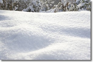
Weather Topic: What is Snow?
Home - Education - Precipitation - Snow
 Next Topic: Stratocumulus Clouds
Snow is precipitation taking the form of ice crystals. Each ice crystal, or snowflake,
has unique characteristics, but all of them grow in a hexagonal structure.
Snowfall can last for sustained periods of time and result in significant buildup
of snow on the ground.
On the earth's surface, snow starts out light and powdery, but as it begins to melt
it tends to become more granular, producing small bits of ice which have the consistency of
sand. After several cycles of melting and freezing, snow can become very dense
and ice-like, commonly known as snow pack.
Next Topic: Stratocumulus Clouds
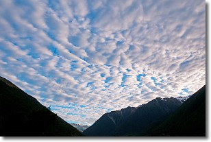
Weather Topic: What are Stratus Clouds?
Home - Education - Cloud Types - Stratus Clouds
 Next Topic: Wall Clouds
Stratus clouds are similar to altostratus clouds, but form at a
lower altitude and are identified by their fog-like appearance, lacking the
distinguishing features of most clouds.
Stratus clouds are wider than most clouds, and their base has a smooth, uniform
look which is lighter in color than a nimbostratus cloud.
The presence of a stratus cloud indicates the possibility of minor precipitation,
such as drizzle, but heavier precipitation does not typically arrive in the form
of a stratus cloud.
Next Topic: Wall Clouds
Current conditions powered by WeatherAPI.com


