Weather Alerts for California
1. Extreme Heat Warning for: Coalinga - Avenal; Fresno-Clovis; West Side Mountains South of 198; Buena Vista; Bakersfield; South End San Joaquin Valley; Fresno-Tulare Foothills; South End Sierra Foothills
2. Extreme Heat Warning for: Cuyama Valley; Santa Clarita Valley; Santa Lucia Mountains; Southern Salinas Valley; San Luis Obispo County Interior Valleys; San Luis Obispo County Mountains; Santa Ynez Valley; Santa Barbara County Interior Mountains; Western Santa Monica Mountains Recreational Area; Calabasas and Agoura Hills; Western San Fernando Valley; Eastern San Fernando Valley; Southeastern Ventura County Valleys; Santa Susana Mountains; Southern Ventura County Mountains; Northern Ventura County Mountains; Interstate 5 Corridor; Western San Gabriel Mountains and Highway 14 Corridor; Eastern San Gabriel Mountains; Western Antelope Valley Foothills; Eastern Antelope Valley Foothills; Antelope Valley; Los Angeles County San Gabriel Valley
3. Extreme Heat Warning for: Santa Ynez Mountains Western Range; Santa Ynez Mountains Eastern Range; Los Angeles County Inland Coast including Downtown Los Angeles; Eastern Santa Monica Mountains Recreational Area
4. Extreme Heat Warning for: Western Siskiyou County; Central Siskiyou County
5. Flash Flood Warning for: Mariposa, CA; Tuolumne, CA
6. Flood Advisory for: Kern, CA
7. Flood Advisory for: Los Angeles, CA
8. Flood Advisory for: Mariposa, CA
9. Flood Advisory for: Riverside, CA; San Diego, CA
10. Flood Advisory for: Tulare, CA
11. Flood Advisory for: Tulare, CA
12. Flood Watch for: Greater Lake Tahoe Area; Greater Lake Tahoe Area; Greater Reno-Carson City-Minden Area; Northern Washoe County
13. Flood Watch for: Mono; Mineral and Southern Lyon Counties
14. Flood Watch for: Yosemite NP outside of the valley; Upper San Joaquin River; Kaiser to Rodgers Ridge; Kings Canyon NP
15. Heat Advisory for: Lake Casitas; Ojai Valley; Central Ventura County Valleys
16. Heat Advisory for: West Side of Fresno and Kings Counties; Caruthers - San Joaquin - Selma; Buttonwillow - Lost Hills - I5; Delano-Wasco-Shafter; Hanford - Corcoran - Lemoore; Visalia - Porterville - Reedley; Southeast San Joaquin Valley; Kern River Valley
17. Red Flag Warning for: Shasta-Trinity National Forest in Siskiyou County; Umpqua National Forest; Western Rogue Basin including the Illinois Valley; Eastern Rogue Valley
18. Red Flag Warning for: Trinity
19. Red Flag Warning for: Western Klamath National Forest; Central Siskiyou County Including Shasta Valley; Siskiyou County from the Cascade Mountains East and South to Mt Shasta; Modoc County Except for the Surprise Valley; Siskiyou Mountains; Southern Oregon Cascades; Klamath Basin and the Fremont-Winema National Forest; South Central Oregon Desert including the BLM Land in Eastern Lake and Western Harney Counties
20. Red Flag Warning for: Western Klamath National Forest; Central Siskiyou County Including Shasta Valley; Siskiyou County from the Cascade Mountains East and South to Mt Shasta; Modoc County Except for the Surprise Valley; Siskiyou Mountains; Southern Oregon Cascades; Klamath Basin and the Fremont-Winema National Forest; South Central Oregon Desert including the BLM Land in Eastern Lake and Western Harney Counties
21. Special Weather Statement for: Kings Canyon NP
22. Special Weather Statement for: Lassen-Eastern Plumas-Eastern Sierra Counties; Greater Reno-Carson City-Minden Area
23. Special Weather Statement for: Lassen-Eastern Plumas-Eastern Sierra Counties; Greater Reno-Carson City-Minden Area; Northern Washoe County
24. Special Weather Statement for: Riverside County Mountains; San Diego County Mountains; San Diego County Deserts
25. Special Weather Statement for: Yosemite NP outside of the valley
26. Special Weather Statement for: Yosemite NP outside of the valley
Want more detail? Get the Complete 7 Day and Night Detailed Forecast!
Current U.S. National Radar--Current
The Current National Weather Radar is shown below with a UTC Time (subtract 5 hours from UTC to get Eastern Time).

National Weather Forecast--Current
The Current National Weather Forecast and National Weather Map are shown below.

National Weather Forecast for Tomorrow
Tomorrow National Weather Forecast and Tomorrow National Weather Map are show below.

North America Water Vapor (Moisture)
This map shows recent moisture content over North America. Bright and colored areas show high moisture (ie, clouds); brown indicates very little moisture present; black indicates no moisture.

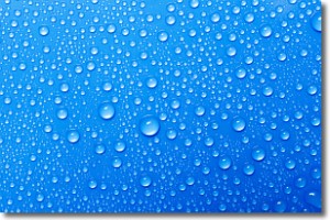
Weather Topic: What is Evaporation?
Home - Education - Precipitation - Evaporation
 Next Topic: Fog
Evaporation is the process which returns water from the earth
back to the atmosphere, and is another crucial process in the water cycle.
Evaporation is the transformation of liquid into gas, and it happens because
molecules are excited by the application of energy and turn into vapor.
In order for water to evaporate it has to be on the surface of a body of water.
Next Topic: Fog
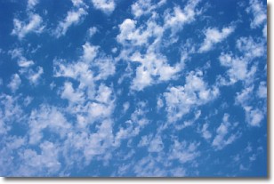
Weather Topic: What are Fractus Clouds?
Home - Education - Cloud Types - Fractus Clouds
 Next Topic: Freezing Rain
A fractus cloud (scud) is a fragmented, tattered cloud which has
likely been sheared off of another cloud. They are accessory clouds, meaning they
develop from parent clouds, and are named in a way which describes the original
cloud which contained them.
Fractus clouds which have originated from cumulus clouds are referred to as
cumulus fractus, while fractus clouds which have originated from stratus clouds
are referred to as stratus fractus. Under certain conditions a fractus cloud might
merge with another cloud, or develop into a cumulus cloud, but usually a
fractus cloud seen by itself will dissipate rapidly.
They are often observed on the leading and trailing edges of storm clouds,
and are a display of wind activity.
Next Topic: Freezing Rain
Current conditions powered by WeatherAPI.com


